You are here: Home > Network List > CI - Caltech Regional Seismic Network Stations List
> Station MPM Manuel Prospect Mine, California, USA > Earthquake Result Viewer
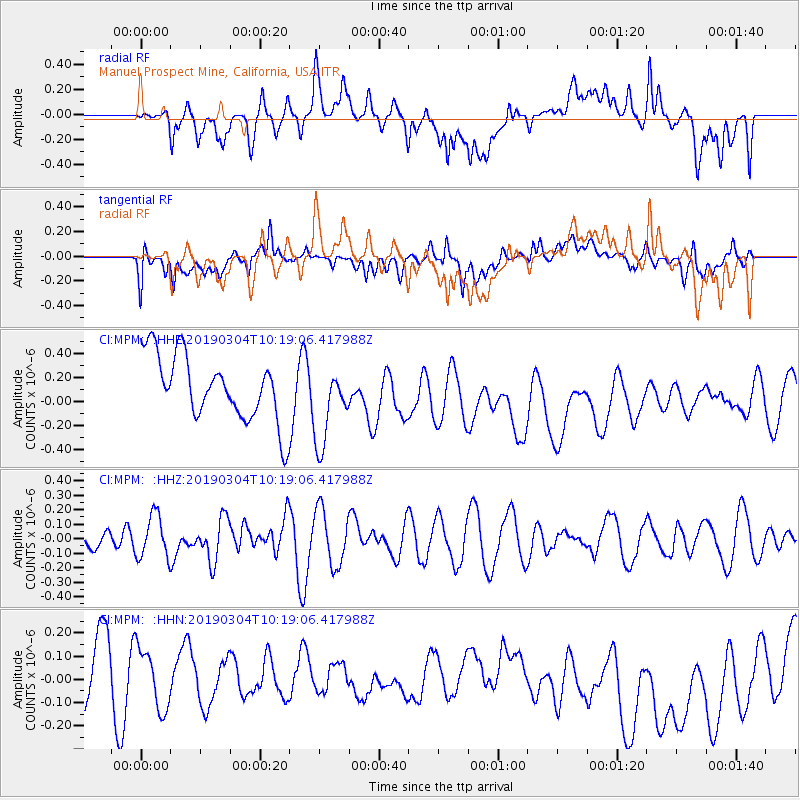
MPM Manuel Prospect Mine, California, USA - Earthquake Result Viewer
*The percent match for this event was below the threshold and hence no stack was calculated.
| Earthquake location: |
Eastern New Guinea Reg., P.N.G. |
| Earthquake latitude/longitude: |
-5.2/146.2 |
| Earthquake time(UTC): |
2019/03/04 (063) 10:06:01 GMT |
| Earthquake Depth: |
10 km |
| Earthquake Magnitude: |
5.9 Mww |
| Earthquake Catalog/Contributor: |
NEIC PDE/us |
|
| Network: |
CI Caltech Regional Seismic Network |
| Station: |
MPM Manuel Prospect Mine, California, USA |
| Lat/Lon: |
36.06 N/117.49 W |
| Elevation: |
185 m |
|
| Distance: |
98.2 deg |
| Az: |
54.45 deg |
| Baz: |
269.469 deg |
| Ray Param: |
$rayparam |
*The percent match for this event was below the threshold and hence was not used in the summary stack. |
|
| Radial Match: |
36.94611 % |
| Radial Bump: |
400 |
| Transverse Match: |
34.40394 % |
| Transverse Bump: |
400 |
| SOD ConfigId: |
13570011 |
| Insert Time: |
2019-05-02 15:43:56.849 +0000 |
| GWidth: |
2.5 |
| Max Bumps: |
400 |
| Tol: |
0.001 |
|
Signal To Noise
| Channel | StoN | STA | LTA |
| CI:MPM: :HHZ:20190304T10:19:06.417988Z | 1.1136569 | 1.4900905E-7 | 1.3380158E-7 |
| CI:MPM: :HHN:20190304T10:19:06.417988Z | 0.70082897 | 1.6076544E-7 | 2.2939324E-7 |
| CI:MPM: :HHE:20190304T10:19:06.417988Z | 1.2398385 | 3.3435512E-7 | 2.6967635E-7 |
| Arrivals |
| Ps | |
| PpPs | |
| PsPs/PpSs | |


