You are here: Home > Network List > TA - USArray Transportable Network (new EarthScope stations) Stations List
> Station I30M Mount Dempster, Yukon, CAN > Earthquake Result Viewer
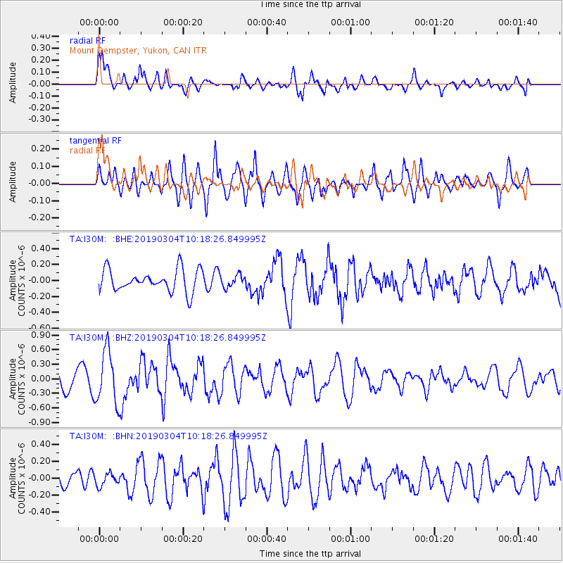
I30M Mount Dempster, Yukon, CAN - Earthquake Result Viewer
*The percent match for this event was below the threshold and hence no stack was calculated.
| Earthquake location: |
Eastern New Guinea Reg., P.N.G. |
| Earthquake latitude/longitude: |
-5.2/146.2 |
| Earthquake time(UTC): |
2019/03/04 (063) 10:06:01 GMT |
| Earthquake Depth: |
10 km |
| Earthquake Magnitude: |
5.9 Mww |
| Earthquake Catalog/Contributor: |
NEIC PDE/us |
|
| Network: |
TA USArray Transportable Network (new EarthScope stations) |
| Station: |
I30M Mount Dempster, Yukon, CAN |
| Lat/Lon: |
65.22 N/136.38 W |
| Elevation: |
1399 m |
|
| Distance: |
89.5 deg |
| Az: |
24.289 deg |
| Baz: |
256.428 deg |
| Ray Param: |
$rayparam |
*The percent match for this event was below the threshold and hence was not used in the summary stack. |
|
| Radial Match: |
64.04812 % |
| Radial Bump: |
400 |
| Transverse Match: |
69.37791 % |
| Transverse Bump: |
400 |
| SOD ConfigId: |
13570011 |
| Insert Time: |
2019-05-02 15:46:53.876 +0000 |
| GWidth: |
2.5 |
| Max Bumps: |
400 |
| Tol: |
0.001 |
|
Signal To Noise
| Channel | StoN | STA | LTA |
| TA:I30M: :BHZ:20190304T10:18:26.849995Z | 2.6299565 | 5.542594E-7 | 2.1074848E-7 |
| TA:I30M: :BHN:20190304T10:18:26.849995Z | 0.6040316 | 7.645073E-8 | 1.2656743E-7 |
| TA:I30M: :BHE:20190304T10:18:26.849995Z | 0.56431025 | 7.77629E-8 | 1.3780168E-7 |
| Arrivals |
| Ps | |
| PpPs | |
| PsPs/PpSs | |


