You are here: Home > Network List > GS - US Geological Survey Networks Stations List
> Station KAN13 Rinehart Farm > Earthquake Result Viewer
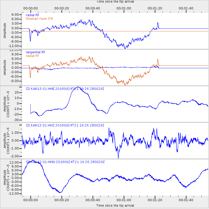
KAN13 Rinehart Farm - Earthquake Result Viewer
*The percent match for this event was below the threshold and hence no stack was calculated.
| Earthquake location: |
Tonga Islands |
| Earthquake latitude/longitude: |
-18.1/-175.0 |
| Earthquake time(UTC): |
2016/09/24 (268) 21:07:13 GMT |
| Earthquake Depth: |
179 km |
| Earthquake Magnitude: |
6.3 MO |
| Earthquake Catalog/Contributor: |
NEIC PDE/NEIC ALERT |
|
| Network: |
GS US Geological Survey Networks |
| Station: |
KAN13 Rinehart Farm |
| Lat/Lon: |
37.01 N/97.48 W |
| Elevation: |
340 m |
|
| Distance: |
91.2 deg |
| Az: |
51.417 deg |
| Baz: |
248.265 deg |
| Ray Param: |
$rayparam |
*The percent match for this event was below the threshold and hence was not used in the summary stack. |
|
| Radial Match: |
45.847233 % |
| Radial Bump: |
400 |
| Transverse Match: |
28.04658 % |
| Transverse Bump: |
400 |
| SOD ConfigId: |
1634031 |
| Insert Time: |
2016-10-08 21:08:36.224 +0000 |
| GWidth: |
2.5 |
| Max Bumps: |
400 |
| Tol: |
0.001 |
|
Signal To Noise
| Channel | StoN | STA | LTA |
| GS:KAN13:01:HHZ:20160924T21:19:26.280029Z | 0.84992546 | 2.2880964E-7 | 2.6921143E-7 |
| GS:KAN13:01:HHN:20160924T21:19:26.280029Z | 6.2243385 | 1.7945837E-5 | 2.8831716E-6 |
| GS:KAN13:01:HHE:20160924T21:19:26.280029Z | 7.3027406 | 4.007344E-5 | 5.4874517E-6 |
| Arrivals |
| Ps | |
| PpPs | |
| PsPs/PpSs | |


