You are here: Home > Network List > TA - USArray Transportable Network (new EarthScope stations) Stations List
> Station P19A Cripple Cowboy Ranch, Baxter Pass, CO, USA > Earthquake Result Viewer
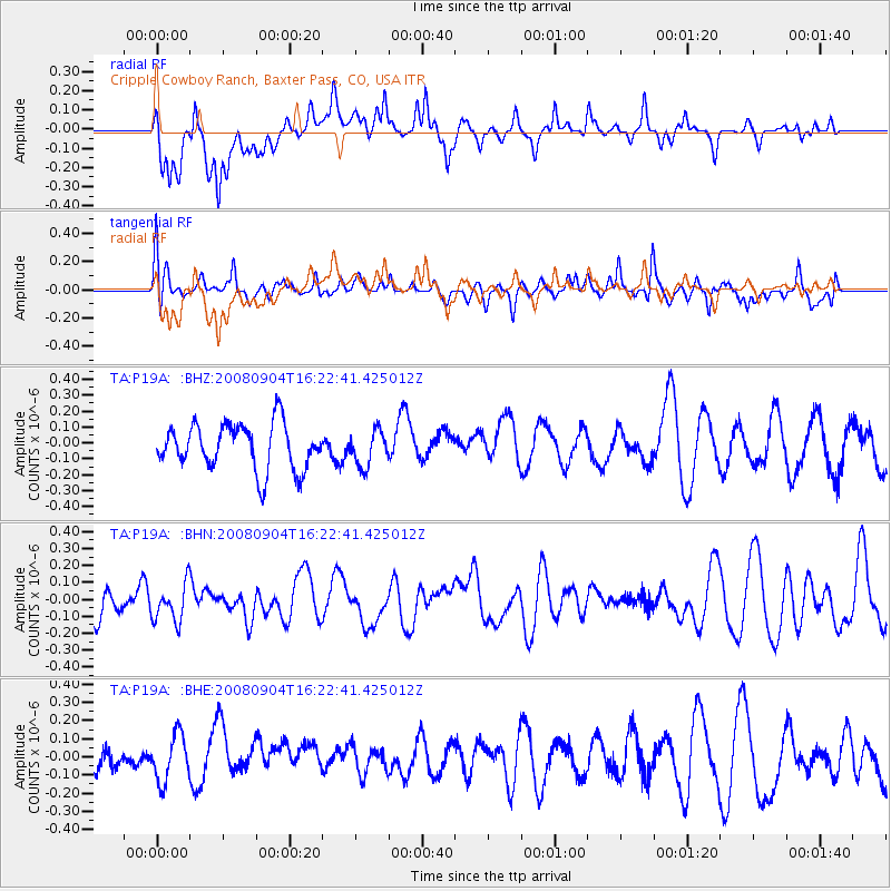
P19A Cripple Cowboy Ranch, Baxter Pass, CO, USA - Earthquake Result Viewer
*The percent match for this event was below the threshold and hence no stack was calculated.
| Earthquake location: |
Kermadec Islands Region |
| Earthquake latitude/longitude: |
-31.6/-177.8 |
| Earthquake time(UTC): |
2008/09/04 (248) 16:09:51 GMT |
| Earthquake Depth: |
26 km |
| Earthquake Magnitude: |
5.5 MB, 5.9 MS, 5.8 MW, 5.7 MW |
| Earthquake Catalog/Contributor: |
WHDF/NEIC |
|
| Network: |
TA USArray Transportable Network (new EarthScope stations) |
| Station: |
P19A Cripple Cowboy Ranch, Baxter Pass, CO, USA |
| Lat/Lon: |
39.63 N/108.98 W |
| Elevation: |
2099 m |
|
| Distance: |
95.3 deg |
| Az: |
46.321 deg |
| Baz: |
233.083 deg |
| Ray Param: |
$rayparam |
*The percent match for this event was below the threshold and hence was not used in the summary stack. |
|
| Radial Match: |
56.390984 % |
| Radial Bump: |
400 |
| Transverse Match: |
57.934696 % |
| Transverse Bump: |
400 |
| SOD ConfigId: |
2504 |
| Insert Time: |
2010-03-06 20:34:43.241 +0000 |
| GWidth: |
2.5 |
| Max Bumps: |
400 |
| Tol: |
0.001 |
|
Signal To Noise
| Channel | StoN | STA | LTA |
| TA:P19A: :BHN:20080904T16:22:41.425012Z | 0.7869502 | 1.113121E-7 | 1.4144746E-7 |
| TA:P19A: :BHE:20080904T16:22:41.425012Z | 1.4116858 | 1.286705E-7 | 9.114669E-8 |
| TA:P19A: :BHZ:20080904T16:22:41.425012Z | 0.75865686 | 1.0901573E-7 | 1.436957E-7 |
| Arrivals |
| Ps | |
| PpPs | |
| PsPs/PpSs | |


