You are here: Home > Network List > CI - Caltech Regional Seismic Network Stations List
> Station MPP McPhearson Peak > Earthquake Result Viewer
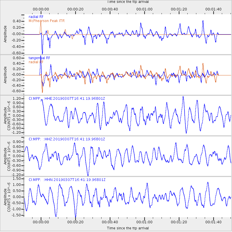
MPP McPhearson Peak - Earthquake Result Viewer
*The percent match for this event was below the threshold and hence no stack was calculated.
| Earthquake location: |
South Of Kermadec Islands |
| Earthquake latitude/longitude: |
-32.5/-178.4 |
| Earthquake time(UTC): |
2019/03/07 (066) 16:29:09 GMT |
| Earthquake Depth: |
21 km |
| Earthquake Magnitude: |
5.7 Mww |
| Earthquake Catalog/Contributor: |
NEIC PDE/us |
|
| Network: |
CI Caltech Regional Seismic Network |
| Station: |
MPP McPhearson Peak |
| Lat/Lon: |
34.89 N/119.81 W |
| Elevation: |
1739 m |
|
| Distance: |
86.7 deg |
| Az: |
44.65 deg |
| Baz: |
226.27 deg |
| Ray Param: |
$rayparam |
*The percent match for this event was below the threshold and hence was not used in the summary stack. |
|
| Radial Match: |
63.61948 % |
| Radial Bump: |
400 |
| Transverse Match: |
60.499233 % |
| Transverse Bump: |
400 |
| SOD ConfigId: |
13570011 |
| Insert Time: |
2019-05-02 16:47:07.738 +0000 |
| GWidth: |
2.5 |
| Max Bumps: |
400 |
| Tol: |
0.001 |
|
Signal To Noise
| Channel | StoN | STA | LTA |
| CI:MPP: :HHZ:20190307T16:41:19.96801Z | 1.5252392 | 5.178642E-7 | 3.395298E-7 |
| CI:MPP: :HHN:20190307T16:41:19.96801Z | 0.74152476 | 3.2790606E-7 | 4.4220513E-7 |
| CI:MPP: :HHE:20190307T16:41:19.96801Z | 1.1296962 | 5.2095896E-7 | 4.6114957E-7 |
| Arrivals |
| Ps | |
| PpPs | |
| PsPs/PpSs | |


