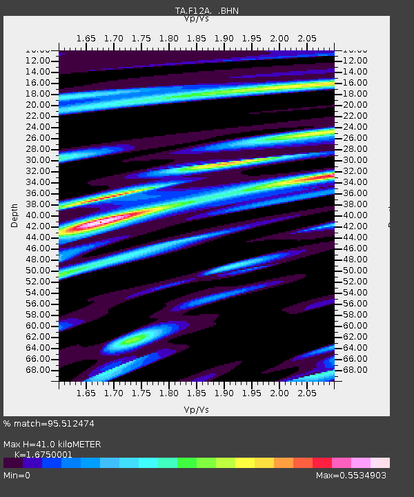
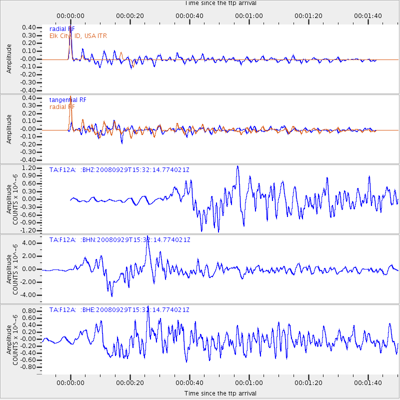
F12A Elk City, ID, USA - Earthquake Result Viewer

Earthquake location: Kermadec Islands, New Zealand
Earthquake latitude/longitude: -29.8/-177.7
Earthquake time(UTC): 2008/09/29 (273) 15:19:31 GMT
Earthquake Depth: 36 km
Earthquake Magnitude: 6.5 MB, 6.7 MS, 7.0 MW, 7.0 MW
Earthquake Catalog/Contributor: WHDF/NEIC
Network: TA USArray Transportable Network (new EarthScope stations)
Station: F12A Elk City, ID, USA
Lat/Lon: 45.76 N/115.25 W
Elevation: 1442 m
Distance: 94.1 deg
Az: 38.474 deg
Baz: 230.602 deg
Ray Param: 0.041117232
Estimated Moho Depth: 41.0 km
Estimated Crust Vp/Vs: 1.68
Assumed Crust Vp: 6.577 km/s
Estimated Crust Vs: 3.927 km/s
Estimated Crust Poisson's Ratio: 0.22
Radial Match: 95.512474 %
Radial Bump: 400
Transverse Match: 84.5479 %
Transverse Bump: 400
SOD ConfigId: 2560
Insert Time: 2010-03-06 20:37:59.813 +0000
GWidth: 2.5
Max Bumps: 400
Tol: 0.001

Signal To Noise

ChannelStoNSTALTA
TA:F12A: :BHN:20080929T15:32:14.774021Z9.9415056.881374E-76.921863E-8
TA:F12A: :BHE:20080929T15:32:14.774021Z2.11302571.4614936E-76.916592E-8
TA:F12A: :BHZ:20080929T15:32:14.774021Z2.54218841.7172326E-76.754938E-8
Arrivals
Ps4.3 SECOND
PpPs16 SECOND
PsPs/PpSs21 SECOND