F12A Elk City, ID, USA - Earthquake Result Viewer
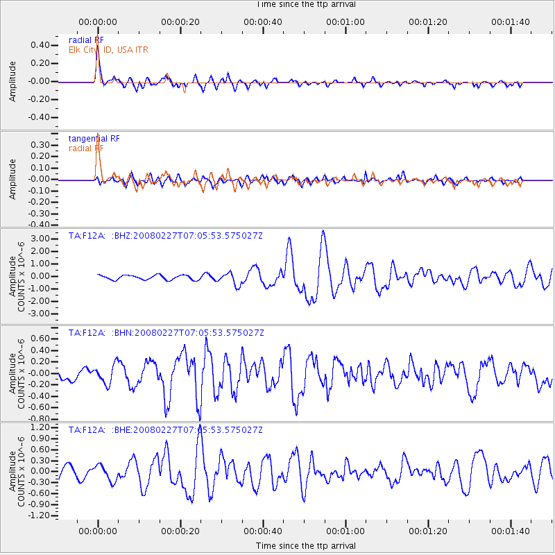
Earthquake location: Bonin Islands, Japan Region
Earthquake latitude/longitude: 26.8/142.4
Earthquake time(UTC): 2008/02/27 (058) 06:54:20 GMT
Earthquake Depth: 15 km
Earthquake Magnitude: 5.8 MB, 6.1 MS, 6.2 MW, 6.2 MW
Earthquake Catalog/Contributor: WHDF/NEIC
Network: TA USArray Transportable Network (new EarthScope stations)
Station: F12A Elk City, ID, USA
Lat/Lon: 45.76 N/115.25 W
Elevation: 1442 m
Distance: 79.2 deg
Az: 44.132 deg
Baz: 297.275 deg
Ray Param: 0.049100902
Estimated Moho Depth: 41.25 km
Estimated Crust Vp/Vs: 1.61
Assumed Crust Vp: 6.577 km/s
Estimated Crust Vs: 4.098 km/s
Estimated Crust Poisson's Ratio: 0.18
Radial Match: 86.84769 %
Radial Bump: 400
Transverse Match: 58.16647 %
Transverse Bump: 400
SOD ConfigId: 2564
Insert Time: 2010-03-06 20:38:01.857 +0000
GWidth: 2.5
Max Bumps: 400
Tol: 0.001

Signal To Noise

ChannelStoNSTALTA
TA:F12A: :BHN:20080227T07:05:53.575027Z1.58932911.6822969E-71.058495E-7
TA:F12A: :BHE:20080227T07:05:53.575027Z1.46995222.1853432E-71.4866764E-7
TA:F12A: :BHZ:20080227T07:05:53.575027Z2.71620444.950622E-71.822625E-7
Arrivals
Ps3.9 SECOND
PpPs16 SECOND
PsPs/PpSs20 SECOND