You are here: Home > Network List > TA - USArray Transportable Network (new EarthScope stations) Stations List
> Station G16K Koyuk River, AK, USA > Earthquake Result Viewer
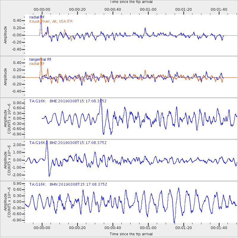
G16K Koyuk River, AK, USA - Earthquake Result Viewer
*The percent match for this event was below the threshold and hence no stack was calculated.
| Earthquake location: |
Philippine Islands Region |
| Earthquake latitude/longitude: |
10.4/126.1 |
| Earthquake time(UTC): |
2019/03/08 (067) 15:06:16 GMT |
| Earthquake Depth: |
54 km |
| Earthquake Magnitude: |
6.0 Mww |
| Earthquake Catalog/Contributor: |
NEIC PDE/us |
|
| Network: |
TA USArray Transportable Network (new EarthScope stations) |
| Station: |
G16K Koyuk River, AK, USA |
| Lat/Lon: |
65.39 N/162.35 W |
| Elevation: |
169 m |
|
| Distance: |
73.0 deg |
| Az: |
24.547 deg |
| Baz: |
257.465 deg |
| Ray Param: |
$rayparam |
*The percent match for this event was below the threshold and hence was not used in the summary stack. |
|
| Radial Match: |
73.610664 % |
| Radial Bump: |
400 |
| Transverse Match: |
61.594048 % |
| Transverse Bump: |
315 |
| SOD ConfigId: |
13570011 |
| Insert Time: |
2019-05-02 16:55:47.537 +0000 |
| GWidth: |
2.5 |
| Max Bumps: |
400 |
| Tol: |
0.001 |
|
Signal To Noise
| Channel | StoN | STA | LTA |
| TA:G16K: :BHZ:20190308T15:17:08.375Z | 6.530391 | 1.2451596E-6 | 1.9067153E-7 |
| TA:G16K: :BHN:20190308T15:17:08.375Z | 0.8995374 | 1.9719751E-7 | 2.1922104E-7 |
| TA:G16K: :BHE:20190308T15:17:08.375Z | 2.6061053 | 5.692454E-7 | 2.1842764E-7 |
| Arrivals |
| Ps | |
| PpPs | |
| PsPs/PpSs | |


