You are here: Home > Network List > AV - Alaska Volcano Observatory Stations List
> Station SPCR Ckakachatna River, Mount Spurr, Alaska > Earthquake Result Viewer
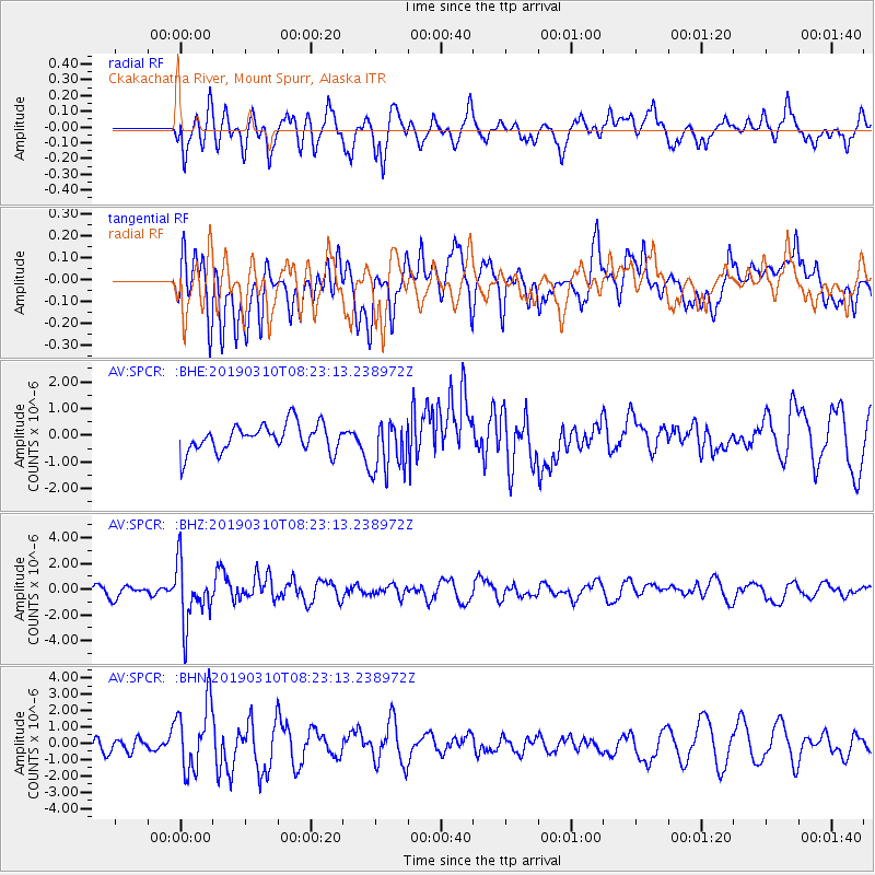
SPCR Ckakachatna River, Mount Spurr, Alaska - Earthquake Result Viewer
*The percent match for this event was below the threshold and hence no stack was calculated.
| Earthquake location: |
Fiji Islands Region |
| Earthquake latitude/longitude: |
-17.8/-178.7 |
| Earthquake time(UTC): |
2019/03/10 (069) 08:12:25 GMT |
| Earthquake Depth: |
567 km |
| Earthquake Magnitude: |
6.2 Mww |
| Earthquake Catalog/Contributor: |
NEIC PDE/us |
|
| Network: |
AV Alaska Volcano Observatory |
| Station: |
SPCR Ckakachatna River, Mount Spurr, Alaska |
| Lat/Lon: |
61.20 N/152.21 W |
| Elevation: |
984 m |
|
| Distance: |
81.6 deg |
| Az: |
12.596 deg |
| Baz: |
205.402 deg |
| Ray Param: |
$rayparam |
*The percent match for this event was below the threshold and hence was not used in the summary stack. |
|
| Radial Match: |
63.278133 % |
| Radial Bump: |
400 |
| Transverse Match: |
58.685223 % |
| Transverse Bump: |
400 |
| SOD ConfigId: |
13570011 |
| Insert Time: |
2019-05-02 17:04:15.088 +0000 |
| GWidth: |
2.5 |
| Max Bumps: |
400 |
| Tol: |
0.001 |
|
Signal To Noise
| Channel | StoN | STA | LTA |
| AV:SPCR: :BHZ:20190310T08:23:13.238972Z | 3.8718188 | 2.304764E-6 | 5.952665E-7 |
| AV:SPCR: :BHN:20190310T08:23:13.238972Z | 4.488677 | 2.063041E-6 | 4.5960996E-7 |
| AV:SPCR: :BHE:20190310T08:23:13.238972Z | 2.033886 | 9.991866E-7 | 4.912697E-7 |
| Arrivals |
| Ps | |
| PpPs | |
| PsPs/PpSs | |


