You are here: Home > Network List > GS - US Geological Survey Networks Stations List
> Station KAN10 Keim Farm > Earthquake Result Viewer
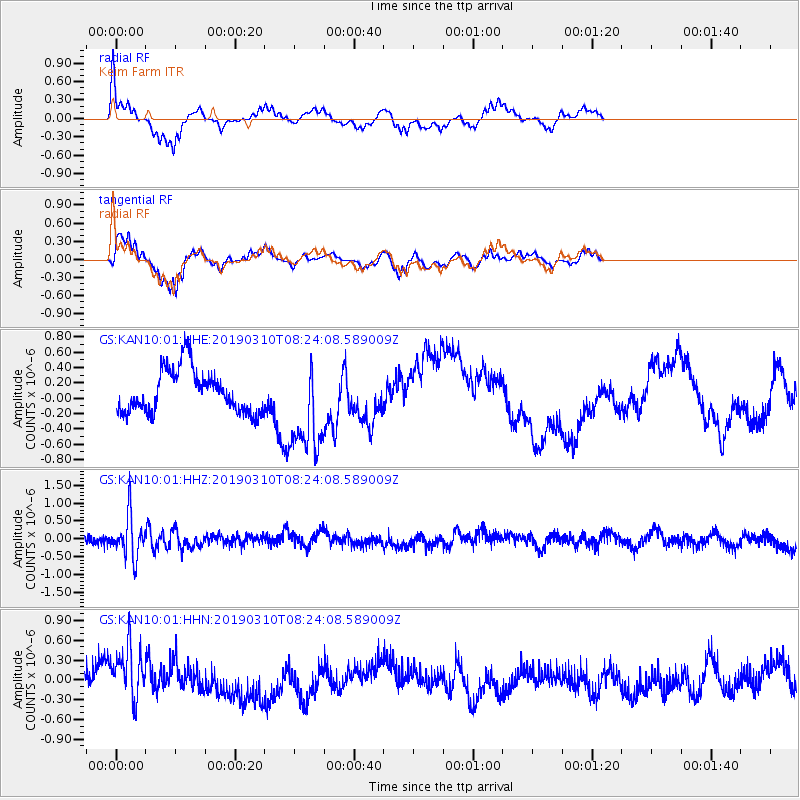
KAN10 Keim Farm - Earthquake Result Viewer
*The percent match for this event was below the threshold and hence no stack was calculated.
| Earthquake location: |
Fiji Islands Region |
| Earthquake latitude/longitude: |
-17.8/-178.7 |
| Earthquake time(UTC): |
2019/03/10 (069) 08:12:25 GMT |
| Earthquake Depth: |
567 km |
| Earthquake Magnitude: |
6.2 Mww |
| Earthquake Catalog/Contributor: |
NEIC PDE/us |
|
| Network: |
GS US Geological Survey Networks |
| Station: |
KAN10 Keim Farm |
| Lat/Lon: |
37.12 N/98.10 W |
| Elevation: |
417 m |
|
| Distance: |
93.3 deg |
| Az: |
52.168 deg |
| Baz: |
250.266 deg |
| Ray Param: |
$rayparam |
*The percent match for this event was below the threshold and hence was not used in the summary stack. |
|
| Radial Match: |
55.012592 % |
| Radial Bump: |
291 |
| Transverse Match: |
47.68357 % |
| Transverse Bump: |
254 |
| SOD ConfigId: |
13570011 |
| Insert Time: |
2019-05-02 17:07:03.286 +0000 |
| GWidth: |
2.5 |
| Max Bumps: |
400 |
| Tol: |
0.001 |
|
Signal To Noise
| Channel | StoN | STA | LTA |
| GS:KAN10:01:HHZ:20190310T08:24:08.589009Z | 3.3643231 | 5.7833995E-7 | 1.719038E-7 |
| GS:KAN10:01:HHN:20190310T08:24:08.589009Z | 2.333991 | 4.1783724E-7 | 1.7902265E-7 |
| GS:KAN10:01:HHE:20190310T08:24:08.589009Z | 2.1206188 | 5.853097E-7 | 2.760089E-7 |
| Arrivals |
| Ps | |
| PpPs | |
| PsPs/PpSs | |


