You are here: Home > Network List > TA - USArray Transportable Network (new EarthScope stations) Stations List
> Station F12A Elk City, ID, USA > Earthquake Result Viewer
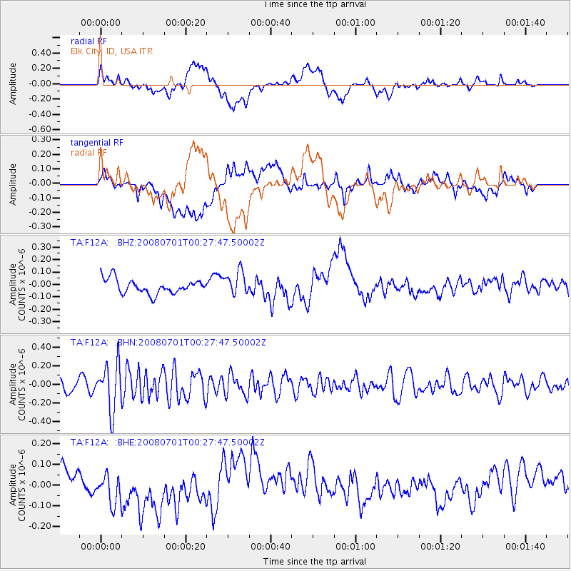
F12A Elk City, ID, USA - Earthquake Result Viewer
*The percent match for this event was below the threshold and hence no stack was calculated.
| Earthquake location: |
Central Peru |
| Earthquake latitude/longitude: |
-10.4/-75.5 |
| Earthquake time(UTC): |
2008/07/01 (183) 00:17:33 GMT |
| Earthquake Depth: |
33 km |
| Earthquake Magnitude: |
5.5 MW, 5.0 MS, 5.4 MB, 5.3 ML |
| Earthquake Catalog/Contributor: |
WHDF/NEIC |
|
| Network: |
TA USArray Transportable Network (new EarthScope stations) |
| Station: |
F12A Elk City, ID, USA |
| Lat/Lon: |
45.76 N/115.25 W |
| Elevation: |
1442 m |
|
| Distance: |
66.3 deg |
| Az: |
330.735 deg |
| Baz: |
136.608 deg |
| Ray Param: |
$rayparam |
*The percent match for this event was below the threshold and hence was not used in the summary stack. |
|
| Radial Match: |
39.529346 % |
| Radial Bump: |
400 |
| Transverse Match: |
29.324562 % |
| Transverse Bump: |
400 |
| SOD ConfigId: |
2504 |
| Insert Time: |
2010-03-06 20:41:10.062 +0000 |
| GWidth: |
2.5 |
| Max Bumps: |
400 |
| Tol: |
0.001 |
|
Signal To Noise
| Channel | StoN | STA | LTA |
| TA:F12A: :BHN:20080701T00:27:47.50002Z | 3.9145029 | 2.5956146E-7 | 6.630765E-8 |
| TA:F12A: :BHE:20080701T00:27:47.50002Z | 1.652276 | 9.409175E-8 | 5.6946757E-8 |
| TA:F12A: :BHZ:20080701T00:27:47.50002Z | 1.6846709 | 9.645886E-8 | 5.72568E-8 |
| Arrivals |
| Ps | |
| PpPs | |
| PsPs/PpSs | |


