You are here: Home > Network List > TA - USArray Transportable Network (new EarthScope stations) Stations List
> Station A21K Barrow, AK, USA > Earthquake Result Viewer
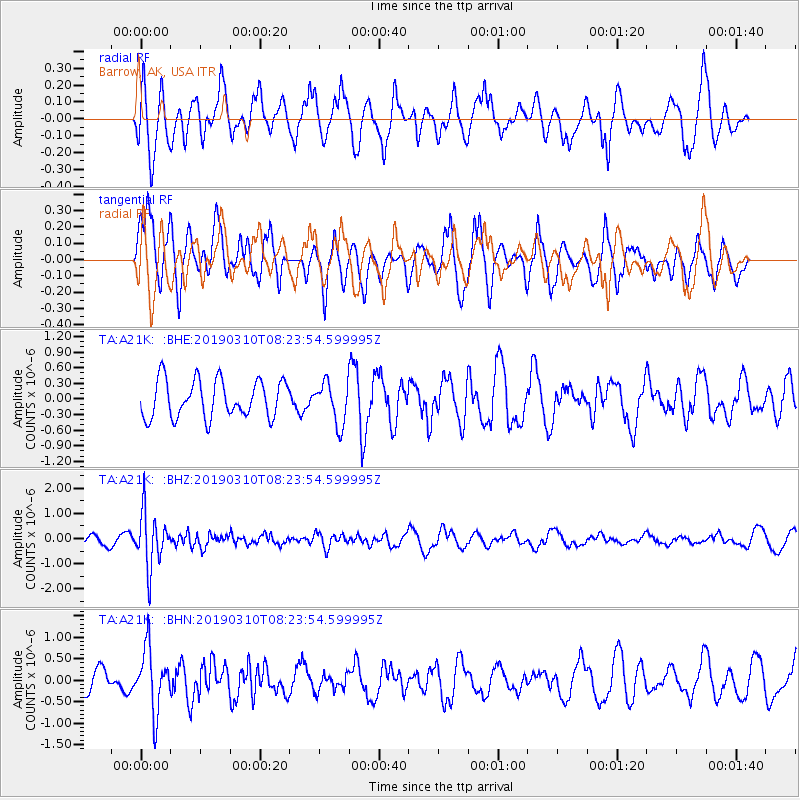
A21K Barrow, AK, USA - Earthquake Result Viewer
*The percent match for this event was below the threshold and hence no stack was calculated.
| Earthquake location: |
Fiji Islands Region |
| Earthquake latitude/longitude: |
-17.8/-178.7 |
| Earthquake time(UTC): |
2019/03/10 (069) 08:12:25 GMT |
| Earthquake Depth: |
567 km |
| Earthquake Magnitude: |
6.2 Mww |
| Earthquake Catalog/Contributor: |
NEIC PDE/us |
|
| Network: |
TA USArray Transportable Network (new EarthScope stations) |
| Station: |
A21K Barrow, AK, USA |
| Lat/Lon: |
71.32 N/156.62 W |
| Elevation: |
577 m |
|
| Distance: |
90.2 deg |
| Az: |
6.945 deg |
| Baz: |
200.948 deg |
| Ray Param: |
$rayparam |
*The percent match for this event was below the threshold and hence was not used in the summary stack. |
|
| Radial Match: |
59.924828 % |
| Radial Bump: |
364 |
| Transverse Match: |
50.213116 % |
| Transverse Bump: |
323 |
| SOD ConfigId: |
13570011 |
| Insert Time: |
2019-05-02 17:09:57.374 +0000 |
| GWidth: |
2.5 |
| Max Bumps: |
400 |
| Tol: |
0.001 |
|
Signal To Noise
| Channel | StoN | STA | LTA |
| TA:A21K: :BHZ:20190310T08:23:54.599995Z | 7.486093 | 1.0767142E-6 | 1.4382857E-7 |
| TA:A21K: :BHN:20190310T08:23:54.599995Z | 2.0970016 | 7.221518E-7 | 3.4437352E-7 |
| TA:A21K: :BHE:20190310T08:23:54.599995Z | 1.1634834 | 4.1917414E-7 | 3.6027512E-7 |
| Arrivals |
| Ps | |
| PpPs | |
| PsPs/PpSs | |


