You are here: Home > Network List > TA - USArray Transportable Network (new EarthScope stations) Stations List
> Station E20K Nigu River, AK, USA > Earthquake Result Viewer
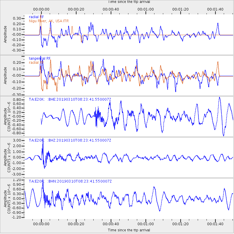
E20K Nigu River, AK, USA - Earthquake Result Viewer
*The percent match for this event was below the threshold and hence no stack was calculated.
| Earthquake location: |
Fiji Islands Region |
| Earthquake latitude/longitude: |
-17.8/-178.7 |
| Earthquake time(UTC): |
2019/03/10 (069) 08:12:25 GMT |
| Earthquake Depth: |
567 km |
| Earthquake Magnitude: |
6.2 Mww |
| Earthquake Catalog/Contributor: |
NEIC PDE/us |
|
| Network: |
TA USArray Transportable Network (new EarthScope stations) |
| Station: |
E20K Nigu River, AK, USA |
| Lat/Lon: |
68.26 N/156.19 W |
| Elevation: |
866 m |
|
| Distance: |
87.4 deg |
| Az: |
8.197 deg |
| Baz: |
201.377 deg |
| Ray Param: |
$rayparam |
*The percent match for this event was below the threshold and hence was not used in the summary stack. |
|
| Radial Match: |
65.19311 % |
| Radial Bump: |
400 |
| Transverse Match: |
68.41157 % |
| Transverse Bump: |
382 |
| SOD ConfigId: |
13570011 |
| Insert Time: |
2019-05-02 17:10:15.277 +0000 |
| GWidth: |
2.5 |
| Max Bumps: |
400 |
| Tol: |
0.001 |
|
Signal To Noise
| Channel | StoN | STA | LTA |
| TA:E20K: :BHZ:20190310T08:23:41.550007Z | 6.4312515 | 1.0809385E-6 | 1.6807591E-7 |
| TA:E20K: :BHN:20190310T08:23:41.550007Z | 1.3565961 | 4.1526408E-7 | 3.0610735E-7 |
| TA:E20K: :BHE:20190310T08:23:41.550007Z | 0.93317187 | 1.967043E-7 | 2.1079109E-7 |
| Arrivals |
| Ps | |
| PpPs | |
| PsPs/PpSs | |


