You are here: Home > Network List > TA - USArray Transportable Network (new EarthScope stations) Stations List
> Station G16K Koyuk River, AK, USA > Earthquake Result Viewer
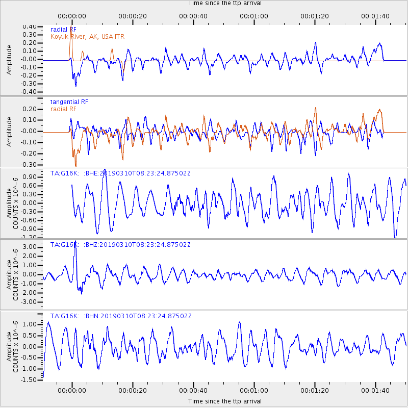
G16K Koyuk River, AK, USA - Earthquake Result Viewer
*The percent match for this event was below the threshold and hence no stack was calculated.
| Earthquake location: |
Fiji Islands Region |
| Earthquake latitude/longitude: |
-17.8/-178.7 |
| Earthquake time(UTC): |
2019/03/10 (069) 08:12:25 GMT |
| Earthquake Depth: |
567 km |
| Earthquake Magnitude: |
6.2 Mww |
| Earthquake Catalog/Contributor: |
NEIC PDE/us |
|
| Network: |
TA USArray Transportable Network (new EarthScope stations) |
| Station: |
G16K Koyuk River, AK, USA |
| Lat/Lon: |
65.39 N/162.35 W |
| Elevation: |
169 m |
|
| Distance: |
83.9 deg |
| Az: |
6.79 deg |
| Baz: |
195.604 deg |
| Ray Param: |
$rayparam |
*The percent match for this event was below the threshold and hence was not used in the summary stack. |
|
| Radial Match: |
62.396694 % |
| Radial Bump: |
400 |
| Transverse Match: |
46.878544 % |
| Transverse Bump: |
400 |
| SOD ConfigId: |
13570011 |
| Insert Time: |
2019-05-02 17:10:31.606 +0000 |
| GWidth: |
2.5 |
| Max Bumps: |
400 |
| Tol: |
0.001 |
|
Signal To Noise
| Channel | StoN | STA | LTA |
| TA:G16K: :BHZ:20190310T08:23:24.87502Z | 2.9863207 | 1.5300899E-6 | 5.123662E-7 |
| TA:G16K: :BHN:20190310T08:23:24.87502Z | 0.7976746 | 5.1493555E-7 | 6.4554587E-7 |
| TA:G16K: :BHE:20190310T08:23:24.87502Z | 0.61498874 | 3.2008725E-7 | 5.2047665E-7 |
| Arrivals |
| Ps | |
| PpPs | |
| PsPs/PpSs | |


