You are here: Home > Network List > TA - USArray Transportable Network (new EarthScope stations) Stations List
> Station I17K Unalakleet, AK, USA > Earthquake Result Viewer
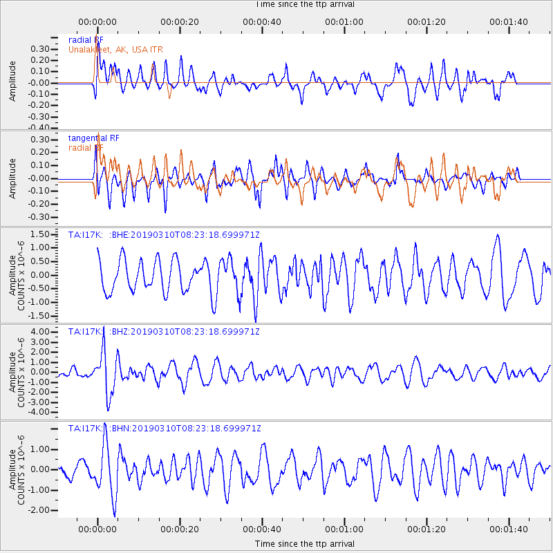
I17K Unalakleet, AK, USA - Earthquake Result Viewer
*The percent match for this event was below the threshold and hence no stack was calculated.
| Earthquake location: |
Fiji Islands Region |
| Earthquake latitude/longitude: |
-17.8/-178.7 |
| Earthquake time(UTC): |
2019/03/10 (069) 08:12:25 GMT |
| Earthquake Depth: |
567 km |
| Earthquake Magnitude: |
6.2 Mww |
| Earthquake Catalog/Contributor: |
NEIC PDE/us |
|
| Network: |
TA USArray Transportable Network (new EarthScope stations) |
| Station: |
I17K Unalakleet, AK, USA |
| Lat/Lon: |
63.89 N/160.70 W |
| Elevation: |
105 m |
|
| Distance: |
82.6 deg |
| Az: |
7.911 deg |
| Baz: |
197.234 deg |
| Ray Param: |
$rayparam |
*The percent match for this event was below the threshold and hence was not used in the summary stack. |
|
| Radial Match: |
56.320072 % |
| Radial Bump: |
400 |
| Transverse Match: |
48.193073 % |
| Transverse Bump: |
400 |
| SOD ConfigId: |
13570011 |
| Insert Time: |
2019-05-02 17:10:51.078 +0000 |
| GWidth: |
2.5 |
| Max Bumps: |
400 |
| Tol: |
0.001 |
|
Signal To Noise
| Channel | StoN | STA | LTA |
| TA:I17K: :BHZ:20190310T08:23:18.699971Z | 4.448564 | 2.1580522E-6 | 4.8511214E-7 |
| TA:I17K: :BHN:20190310T08:23:18.699971Z | 2.0142772 | 1.2787517E-6 | 6.3484396E-7 |
| TA:I17K: :BHE:20190310T08:23:18.699971Z | 1.1428475 | 6.095536E-7 | 5.3336385E-7 |
| Arrivals |
| Ps | |
| PpPs | |
| PsPs/PpSs | |


