You are here: Home > Network List > US - United States National Seismic Network Stations List
> Station MSO Missoula, Montana, USA > Earthquake Result Viewer
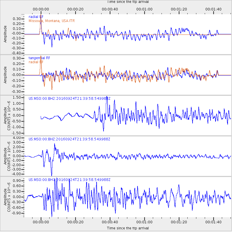
MSO Missoula, Montana, USA - Earthquake Result Viewer
*The percent match for this event was below the threshold and hence no stack was calculated.
| Earthquake location: |
Fiji Islands Region |
| Earthquake latitude/longitude: |
-19.8/-178.3 |
| Earthquake time(UTC): |
2016/09/24 (268) 21:28:42 GMT |
| Earthquake Depth: |
594 km |
| Earthquake Magnitude: |
6.8 MO |
| Earthquake Catalog/Contributor: |
NEIC PDE/NEIC ALERT |
|
| Network: |
US United States National Seismic Network |
| Station: |
MSO Missoula, Montana, USA |
| Lat/Lon: |
46.83 N/113.94 W |
| Elevation: |
1264 m |
|
| Distance: |
88.0 deg |
| Az: |
38.259 deg |
| Baz: |
238.101 deg |
| Ray Param: |
$rayparam |
*The percent match for this event was below the threshold and hence was not used in the summary stack. |
|
| Radial Match: |
69.98534 % |
| Radial Bump: |
400 |
| Transverse Match: |
71.86227 % |
| Transverse Bump: |
400 |
| SOD ConfigId: |
1634031 |
| Insert Time: |
2016-10-08 21:32:04.930 +0000 |
| GWidth: |
2.5 |
| Max Bumps: |
400 |
| Tol: |
0.001 |
|
Signal To Noise
| Channel | StoN | STA | LTA |
| US:MSO:00:BHZ:20160924T21:39:58.549988Z | 6.5593348 | 9.630071E-7 | 1.4681476E-7 |
| US:MSO:00:BH1:20160924T21:39:58.549988Z | 2.4149725 | 2.819385E-7 | 1.1674606E-7 |
| US:MSO:00:BH2:20160924T21:39:58.549988Z | 2.2701478 | 3.3616556E-7 | 1.4808091E-7 |
| Arrivals |
| Ps | |
| PpPs | |
| PsPs/PpSs | |


