You are here: Home > Network List > UW - Pacific Northwest Regional Seismic Network Stations List
> Station LEBA Lebam, WA, USA > Earthquake Result Viewer
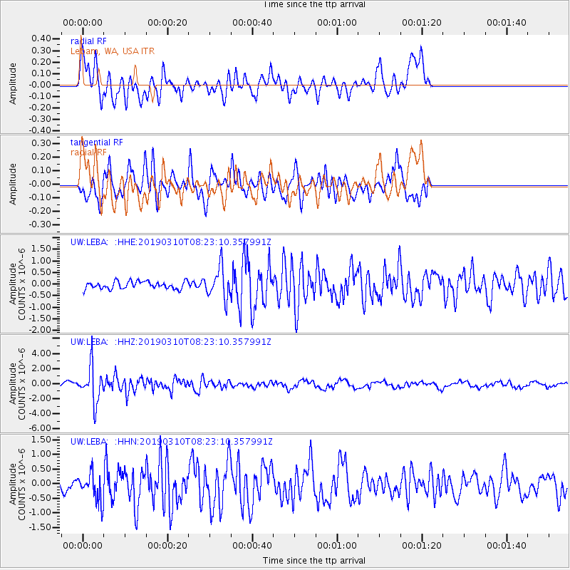
LEBA Lebam, WA, USA - Earthquake Result Viewer
*The percent match for this event was below the threshold and hence no stack was calculated.
| Earthquake location: |
Fiji Islands Region |
| Earthquake latitude/longitude: |
-17.8/-178.7 |
| Earthquake time(UTC): |
2019/03/10 (069) 08:12:25 GMT |
| Earthquake Depth: |
567 km |
| Earthquake Magnitude: |
6.2 Mww |
| Earthquake Catalog/Contributor: |
NEIC PDE/us |
|
| Network: |
UW Pacific Northwest Regional Seismic Network |
| Station: |
LEBA Lebam, WA, USA |
| Lat/Lon: |
46.55 N/123.56 W |
| Elevation: |
73 m |
|
| Distance: |
81.0 deg |
| Az: |
34.965 deg |
| Baz: |
232.27 deg |
| Ray Param: |
$rayparam |
*The percent match for this event was below the threshold and hence was not used in the summary stack. |
|
| Radial Match: |
73.28045 % |
| Radial Bump: |
400 |
| Transverse Match: |
71.68065 % |
| Transverse Bump: |
400 |
| SOD ConfigId: |
13570011 |
| Insert Time: |
2019-05-02 17:13:11.946 +0000 |
| GWidth: |
2.5 |
| Max Bumps: |
400 |
| Tol: |
0.001 |
|
Signal To Noise
| Channel | StoN | STA | LTA |
| UW:LEBA: :HHZ:20190310T08:23:10.357991Z | 7.7424827 | 2.4560422E-6 | 3.1721638E-7 |
| UW:LEBA: :HHN:20190310T08:23:10.357991Z | 1.0858994 | 4.9523203E-7 | 4.5605702E-7 |
| UW:LEBA: :HHE:20190310T08:23:10.357991Z | 4.445069 | 6.921726E-7 | 1.5571696E-7 |
| Arrivals |
| Ps | |
| PpPs | |
| PsPs/PpSs | |


