You are here: Home > Network List > TA - USArray Transportable Network (new EarthScope stations) Stations List
> Station D23K Nanushuk River, AK USA > Earthquake Result Viewer
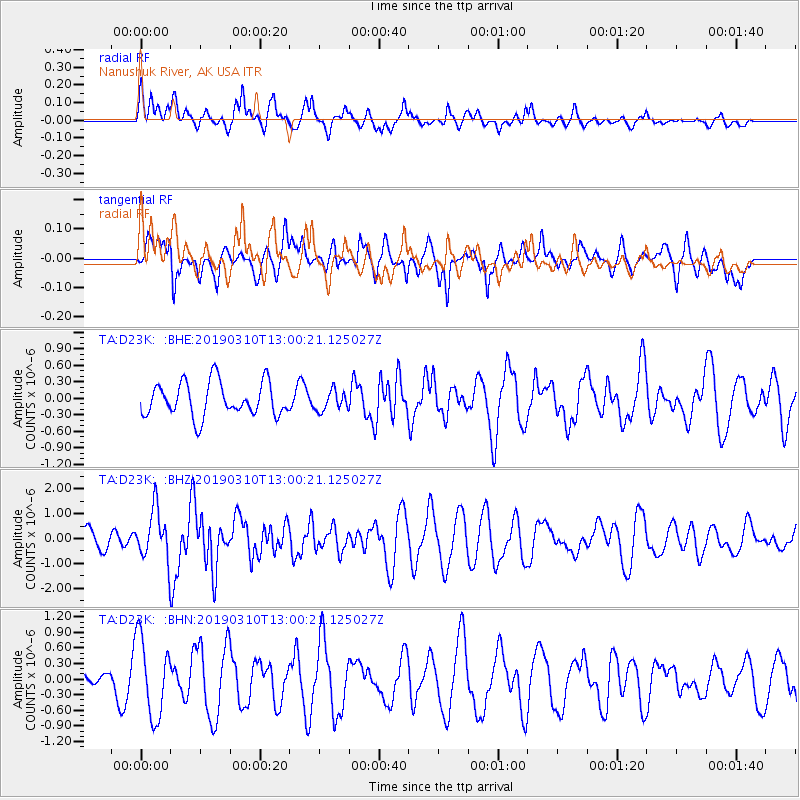
D23K Nanushuk River, AK USA - Earthquake Result Viewer
*The percent match for this event was below the threshold and hence no stack was calculated.
| Earthquake location: |
D'Entrecasteaux Islands Region |
| Earthquake latitude/longitude: |
-10.1/152.1 |
| Earthquake time(UTC): |
2019/03/10 (069) 12:48:00 GMT |
| Earthquake Depth: |
10 km |
| Earthquake Magnitude: |
6.1 Mww |
| Earthquake Catalog/Contributor: |
NEIC PDE/us |
|
| Network: |
TA USArray Transportable Network (new EarthScope stations) |
| Station: |
D23K Nanushuk River, AK USA |
| Lat/Lon: |
68.97 N/150.68 W |
| Elevation: |
406 m |
|
| Distance: |
88.3 deg |
| Az: |
17.687 deg |
| Baz: |
235.952 deg |
| Ray Param: |
$rayparam |
*The percent match for this event was below the threshold and hence was not used in the summary stack. |
|
| Radial Match: |
51.538963 % |
| Radial Bump: |
400 |
| Transverse Match: |
44.039707 % |
| Transverse Bump: |
386 |
| SOD ConfigId: |
13570011 |
| Insert Time: |
2019-05-02 17:18:11.566 +0000 |
| GWidth: |
2.5 |
| Max Bumps: |
400 |
| Tol: |
0.001 |
|
Signal To Noise
| Channel | StoN | STA | LTA |
| TA:D23K: :BHZ:20190310T13:00:21.125027Z | 3.519465 | 1.0144138E-6 | 2.8822956E-7 |
| TA:D23K: :BHN:20190310T13:00:21.125027Z | 3.5227935 | 7.5237847E-7 | 2.1357438E-7 |
| TA:D23K: :BHE:20190310T13:00:21.125027Z | 0.5829209 | 1.7868263E-7 | 3.0652978E-7 |
| Arrivals |
| Ps | |
| PpPs | |
| PsPs/PpSs | |


