You are here: Home > Network List > UW - Pacific Northwest Regional Seismic Network Stations List
> Station UMAT Pilot Rock, OR, USA > Earthquake Result Viewer
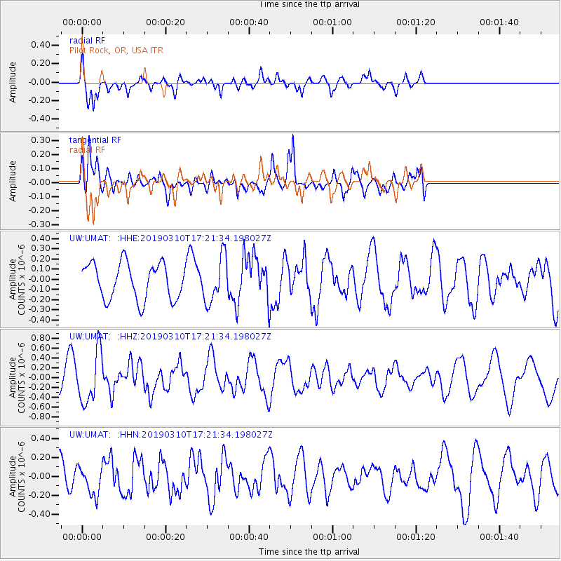
UMAT Pilot Rock, OR, USA - Earthquake Result Viewer
*The percent match for this event was below the threshold and hence no stack was calculated.
| Earthquake location: |
Off East Coast Of Honshu, Japan |
| Earthquake latitude/longitude: |
36.9/142.4 |
| Earthquake time(UTC): |
2019/03/10 (069) 17:10:52 GMT |
| Earthquake Depth: |
15 km |
| Earthquake Magnitude: |
5.8 Mww |
| Earthquake Catalog/Contributor: |
NEIC PDE/us |
|
| Network: |
UW Pacific Northwest Regional Seismic Network |
| Station: |
UMAT Pilot Rock, OR, USA |
| Lat/Lon: |
45.29 N/118.96 W |
| Elevation: |
1318 m |
|
| Distance: |
70.3 deg |
| Az: |
47.847 deg |
| Baz: |
302.605 deg |
| Ray Param: |
$rayparam |
*The percent match for this event was below the threshold and hence was not used in the summary stack. |
|
| Radial Match: |
79.729485 % |
| Radial Bump: |
341 |
| Transverse Match: |
58.767735 % |
| Transverse Bump: |
400 |
| SOD ConfigId: |
13570011 |
| Insert Time: |
2019-05-02 17:27:47.073 +0000 |
| GWidth: |
2.5 |
| Max Bumps: |
400 |
| Tol: |
0.001 |
|
Signal To Noise
| Channel | StoN | STA | LTA |
| UW:UMAT: :HHZ:20190310T17:21:34.198027Z | 2.9819796 | 5.3991283E-7 | 1.8105852E-7 |
| UW:UMAT: :HHN:20190310T17:21:34.198027Z | 1.0882282 | 1.5506755E-7 | 1.4249544E-7 |
| UW:UMAT: :HHE:20190310T17:21:34.198027Z | 1.2938713 | 2.280776E-7 | 1.7627535E-7 |
| Arrivals |
| Ps | |
| PpPs | |
| PsPs/PpSs | |


