You are here: Home > Network List > TA - USArray Transportable Network (new EarthScope stations) Stations List
> Station R11A Troy Canyon, Currant, NV, USA > Earthquake Result Viewer
R11A Troy Canyon, Currant, NV, USA - Earthquake Result Viewer

| Earthquake location: |
Kodiak Island Region, Alaska |
| Earthquake latitude/longitude: |
56.4/-152.4 |
| Earthquake time(UTC): |
2009/05/16 (136) 18:22:25 GMT |
| Earthquake Depth: |
9.7 km |
| Earthquake Magnitude: |
5.9 MS, 5.4 MB, 5.9 MW, 5.8 MW |
| Earthquake Catalog/Contributor: |
WHDF/NEIC |
|
| Network: |
TA USArray Transportable Network (new EarthScope stations) |
| Station: |
R11A Troy Canyon, Currant, NV, USA |
| Lat/Lon: |
38.35 N/115.59 W |
| Elevation: |
1756 m |
|
| Distance: |
30.3 deg |
| Az: |
110.901 deg |
| Baz: |
318.703 deg |
| Ray Param: |
0.07936644 |
| Estimated Moho Depth: |
23.25 km |
| Estimated Crust Vp/Vs: |
1.96 |
| Assumed Crust Vp: |
6.276 km/s |
| Estimated Crust Vs: |
3.206 km/s |
| Estimated Crust Poisson's Ratio: |
0.32 |
|
| Radial Match: |
92.603836 % |
| Radial Bump: |
392 |
| Transverse Match: |
69.25824 % |
| Transverse Bump: |
400 |
| SOD ConfigId: |
2760 |
| Insert Time: |
2010-03-06 20:44:20.148 +0000 |
| GWidth: |
2.5 |
| Max Bumps: |
400 |
| Tol: |
0.001 |
|
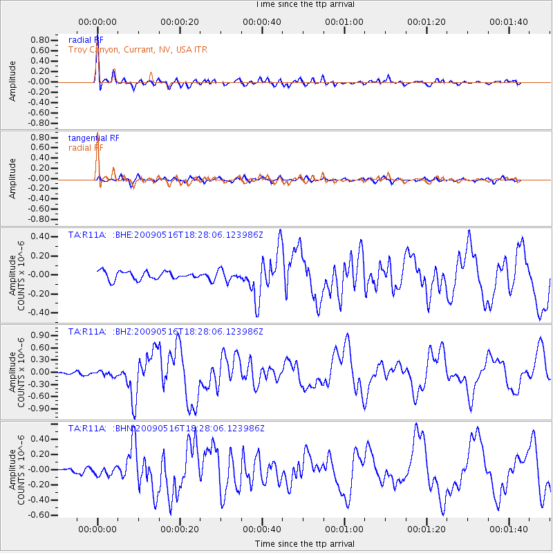
Signal To Noise
| Channel | StoN | STA | LTA |
| TA:R11A: :BHZ:20090516T18:28:06.123986Z | 1.2256035 | 5.900492E-8 | 4.8143566E-8 |
| TA:R11A: :BHN:20090516T18:28:06.123986Z | 1.4106174 | 5.9351994E-8 | 4.207519E-8 |
| TA:R11A: :BHE:20090516T18:28:06.123986Z | 1.2662442 | 5.325487E-8 | 4.2057348E-8 |
| Arrivals |
| Ps | 3.8 SECOND |
| PpPs | 10 SECOND |
| PsPs/PpSs | 14 SECOND |


