You are here: Home > Network List > TA - USArray Transportable Network (new EarthScope stations) Stations List
> Station R11A Troy Canyon, Currant, NV, USA > Earthquake Result Viewer
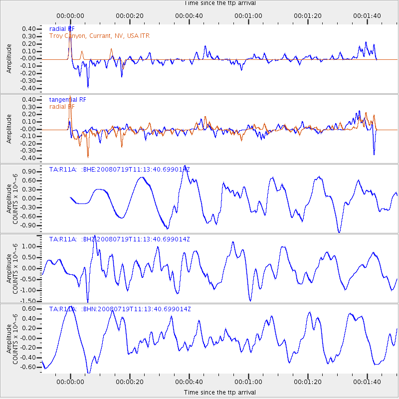
R11A Troy Canyon, Currant, NV, USA - Earthquake Result Viewer
*The percent match for this event was below the threshold and hence no stack was calculated.
| Earthquake location: |
Santa Cruz Islands Region |
| Earthquake latitude/longitude: |
-11.1/164.6 |
| Earthquake time(UTC): |
2008/07/19 (201) 11:01:17 GMT |
| Earthquake Depth: |
10 km |
| Earthquake Magnitude: |
5.8 MB, 5.9 MS, 6.2 MW, 6.2 MW |
| Earthquake Catalog/Contributor: |
WHDF/NEIC |
|
| Network: |
TA USArray Transportable Network (new EarthScope stations) |
| Station: |
R11A Troy Canyon, Currant, NV, USA |
| Lat/Lon: |
38.35 N/115.59 W |
| Elevation: |
1756 m |
|
| Distance: |
88.9 deg |
| Az: |
50.712 deg |
| Baz: |
255.083 deg |
| Ray Param: |
$rayparam |
*The percent match for this event was below the threshold and hence was not used in the summary stack. |
|
| Radial Match: |
75.14179 % |
| Radial Bump: |
394 |
| Transverse Match: |
65.976074 % |
| Transverse Bump: |
368 |
| SOD ConfigId: |
2504 |
| Insert Time: |
2010-03-06 20:44:58.910 +0000 |
| GWidth: |
2.5 |
| Max Bumps: |
400 |
| Tol: |
0.001 |
|
Signal To Noise
| Channel | StoN | STA | LTA |
| TA:R11A: :BHZ:20080719T11:13:40.699014Z | 2.0473287 | 3.7962718E-7 | 1.854256E-7 |
| TA:R11A: :BHN:20080719T11:13:40.699014Z | 1.3870721 | 4.788433E-7 | 3.4521875E-7 |
| TA:R11A: :BHE:20080719T11:13:40.699014Z | 1.9348216 | 7.1480815E-7 | 3.6944397E-7 |
| Arrivals |
| Ps | |
| PpPs | |
| PsPs/PpSs | |


