You are here: Home > Network List > TA - USArray Transportable Network (new EarthScope stations) Stations List
> Station R11A Troy Canyon, Currant, NV, USA > Earthquake Result Viewer
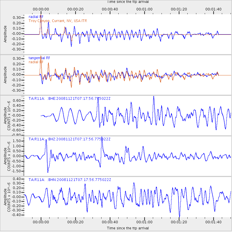
R11A Troy Canyon, Currant, NV, USA - Earthquake Result Viewer
*The percent match for this event was below the threshold and hence no stack was calculated.
| Earthquake location: |
Solomon Islands |
| Earthquake latitude/longitude: |
-8.9/159.6 |
| Earthquake time(UTC): |
2008/11/21 (326) 07:05:34 GMT |
| Earthquake Depth: |
118 km |
| Earthquake Magnitude: |
6.0 MB, 6.1 MW, 6.0 MW |
| Earthquake Catalog/Contributor: |
WHDF/NEIC |
|
| Network: |
TA USArray Transportable Network (new EarthScope stations) |
| Station: |
R11A Troy Canyon, Currant, NV, USA |
| Lat/Lon: |
38.35 N/115.59 W |
| Elevation: |
1756 m |
|
| Distance: |
91.5 deg |
| Az: |
51.57 deg |
| Baz: |
259.851 deg |
| Ray Param: |
$rayparam |
*The percent match for this event was below the threshold and hence was not used in the summary stack. |
|
| Radial Match: |
72.71203 % |
| Radial Bump: |
400 |
| Transverse Match: |
71.04466 % |
| Transverse Bump: |
400 |
| SOD ConfigId: |
2658 |
| Insert Time: |
2010-03-06 20:45:23.176 +0000 |
| GWidth: |
2.5 |
| Max Bumps: |
400 |
| Tol: |
0.001 |
|
Signal To Noise
| Channel | StoN | STA | LTA |
| TA:R11A: :BHZ:20081121T07:17:56.775022Z | 6.1985884 | 8.0726886E-7 | 1.3023431E-7 |
| TA:R11A: :BHN:20081121T07:17:56.775022Z | 1.4041009 | 1.13705546E-7 | 8.098104E-8 |
| TA:R11A: :BHE:20081121T07:17:56.775022Z | 1.8653616 | 3.1277665E-7 | 1.6767615E-7 |
| Arrivals |
| Ps | |
| PpPs | |
| PsPs/PpSs | |


