You are here: Home > Network List > UW - Pacific Northwest Regional Seismic Network Stations List
> Station HOOD Mt Hood Meadows, OR CREST BB SMO > Earthquake Result Viewer
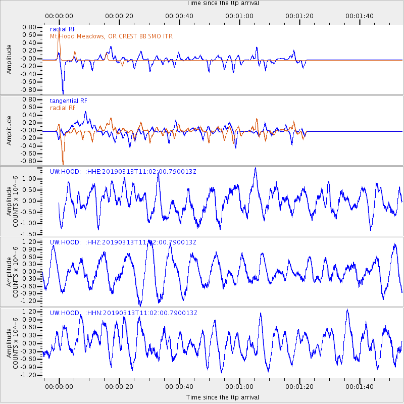
HOOD Mt Hood Meadows, OR CREST BB SMO - Earthquake Result Viewer
*The percent match for this event was below the threshold and hence no stack was calculated.
| Earthquake location: |
Hawaii |
| Earthquake latitude/longitude: |
19.3/-155.2 |
| Earthquake time(UTC): |
2019/03/13 (072) 10:55:13 GMT |
| Earthquake Depth: |
7.0 km |
| Earthquake Magnitude: |
5.5 Ml |
| Earthquake Catalog/Contributor: |
NEIC PDE/hv |
|
| Network: |
UW Pacific Northwest Regional Seismic Network |
| Station: |
HOOD Mt Hood Meadows, OR CREST BB SMO |
| Lat/Lon: |
45.32 N/121.65 W |
| Elevation: |
1520 m |
|
| Distance: |
38.0 deg |
| Az: |
39.331 deg |
| Baz: |
238.032 deg |
| Ray Param: |
$rayparam |
*The percent match for this event was below the threshold and hence was not used in the summary stack. |
|
| Radial Match: |
70.01562 % |
| Radial Bump: |
400 |
| Transverse Match: |
38.809776 % |
| Transverse Bump: |
400 |
| SOD ConfigId: |
13570011 |
| Insert Time: |
2019-05-02 18:02:34.915 +0000 |
| GWidth: |
2.5 |
| Max Bumps: |
400 |
| Tol: |
0.001 |
|
Signal To Noise
| Channel | StoN | STA | LTA |
| UW:HOOD: :HHZ:20190313T11:02:00.790013Z | 1.3690771 | 4.392535E-7 | 3.2083912E-7 |
| UW:HOOD: :HHN:20190313T11:02:00.790013Z | 1.0122154 | 4.7459218E-7 | 4.688648E-7 |
| UW:HOOD: :HHE:20190313T11:02:00.790013Z | 1.3450042 | 6.9413613E-7 | 5.160847E-7 |
| Arrivals |
| Ps | |
| PpPs | |
| PsPs/PpSs | |


