Z27A Tatum, NM, USA - Earthquake Result Viewer
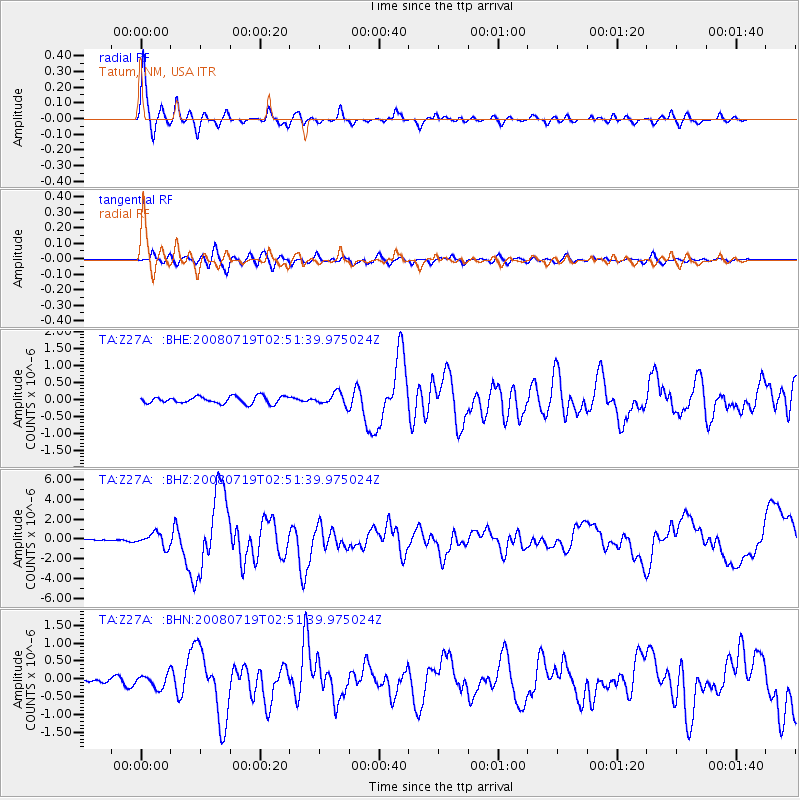
Earthquake location: Off East Coast Of Honshu, Japan
Earthquake latitude/longitude: 37.6/142.2
Earthquake time(UTC): 2008/07/19 (201) 02:39:28 GMT
Earthquake Depth: 22 km
Earthquake Magnitude: 6.2 MB, 7.0 MS, 7.0 MW, 6.9 MW
Earthquake Catalog/Contributor: WHDF/NEIC
Network: TA USArray Transportable Network (new EarthScope stations)
Station: Z27A Tatum, NM, USA
Lat/Lon: 33.31 N/103.21 W
Elevation: 1197 m
Distance: 86.8 deg
Az: 49.701 deg
Baz: 313.623 deg
Ray Param: 0.04373372
Estimated Moho Depth: 49.5 km
Estimated Crust Vp/Vs: 1.73
Assumed Crust Vp: 6.129 km/s
Estimated Crust Vs: 3.548 km/s
Estimated Crust Poisson's Ratio: 0.25
Radial Match: 96.11165 %
Radial Bump: 341
Transverse Match: 82.7759 %
Transverse Bump: 400
SOD ConfigId: 2504
Insert Time: 2010-03-06 20:46:38.166 +0000
GWidth: 2.5
Max Bumps: 400
Tol: 0.001

Signal To Noise

ChannelStoNSTALTA
TA:Z27A: :BHZ:20080719T02:51:39.975024Z6.66410356.8134227E-71.0224065E-7
TA:Z27A: :BHN:20080719T02:51:39.975024Z2.00122931.8730319E-79.359407E-8
TA:Z27A: :BHE:20080719T02:51:39.975024Z1.75518991.7937121E-71.0219476E-7
Arrivals
Ps6.0 SECOND
PpPs22 SECOND
PsPs/PpSs28 SECOND