
Z27A Tatum, NM, USA - Earthquake Result Viewer
| ||||||||||||||||||
| ||||||||||||||||||
| ||||||||||||||||||
|
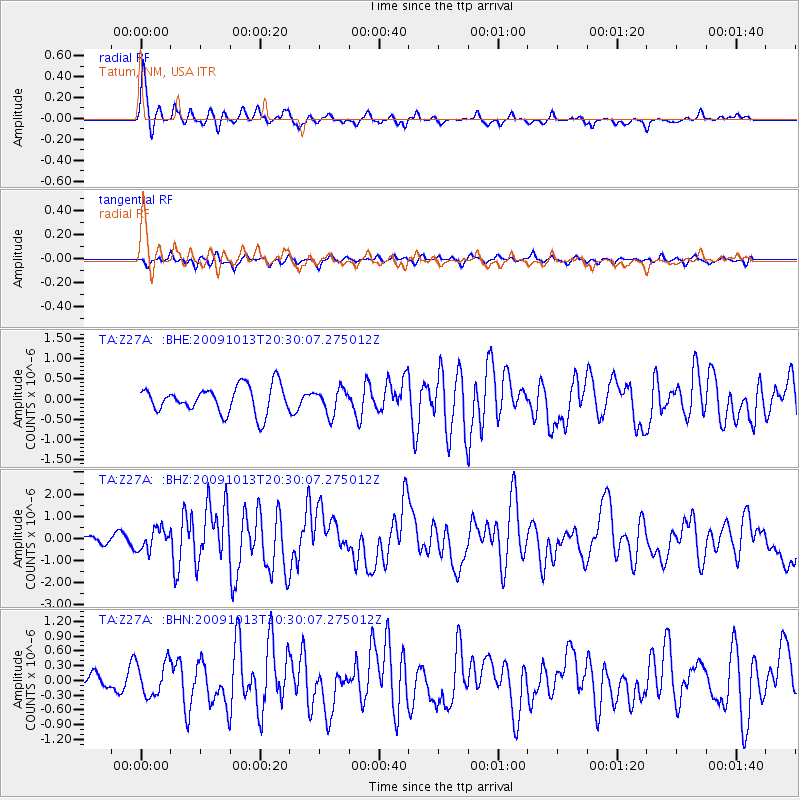
Signal To Noise
| Channel | StoN | STA | LTA |
| TA:Z27A: :BHZ:20091013T20:30:07.275012Z | 4.4155416 | 4.813003E-7 | 1.0900142E-7 |
| TA:Z27A: :BHN:20091013T20:30:07.275012Z | 1.6604655 | 3.3918724E-7 | 2.042724E-7 |
| TA:Z27A: :BHE:20091013T20:30:07.275012Z | 0.9249472 | 3.0868875E-7 | 3.337366E-7 |
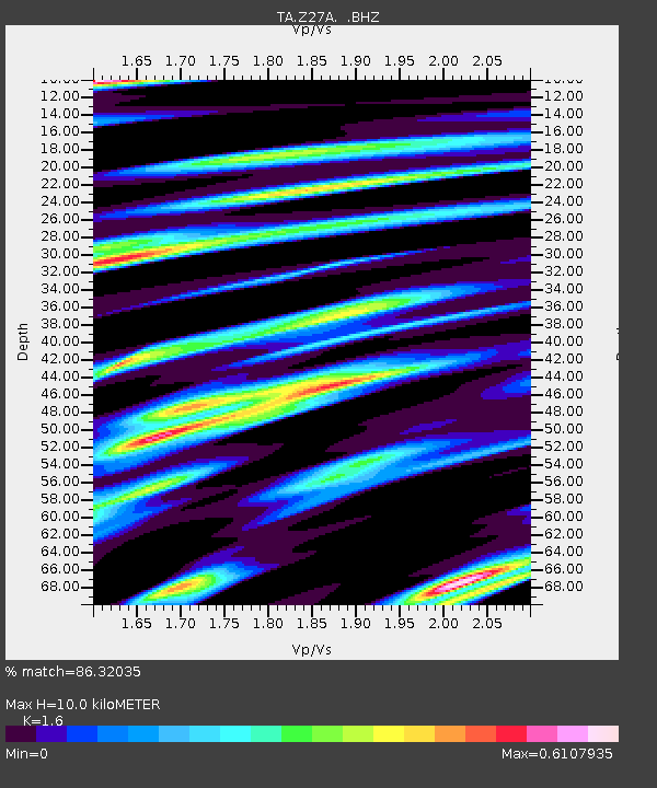
| Arrivals | |
| Ps | 1.0 SECOND |
| PpPs | 4.0 SECOND |
| PsPs/PpSs | 5.0 SECOND |

