You are here: Home > Network List > US - United States National Seismic Network Stations List
> Station DUG Dugway, Tooele County, Utah, USA > Earthquake Result Viewer
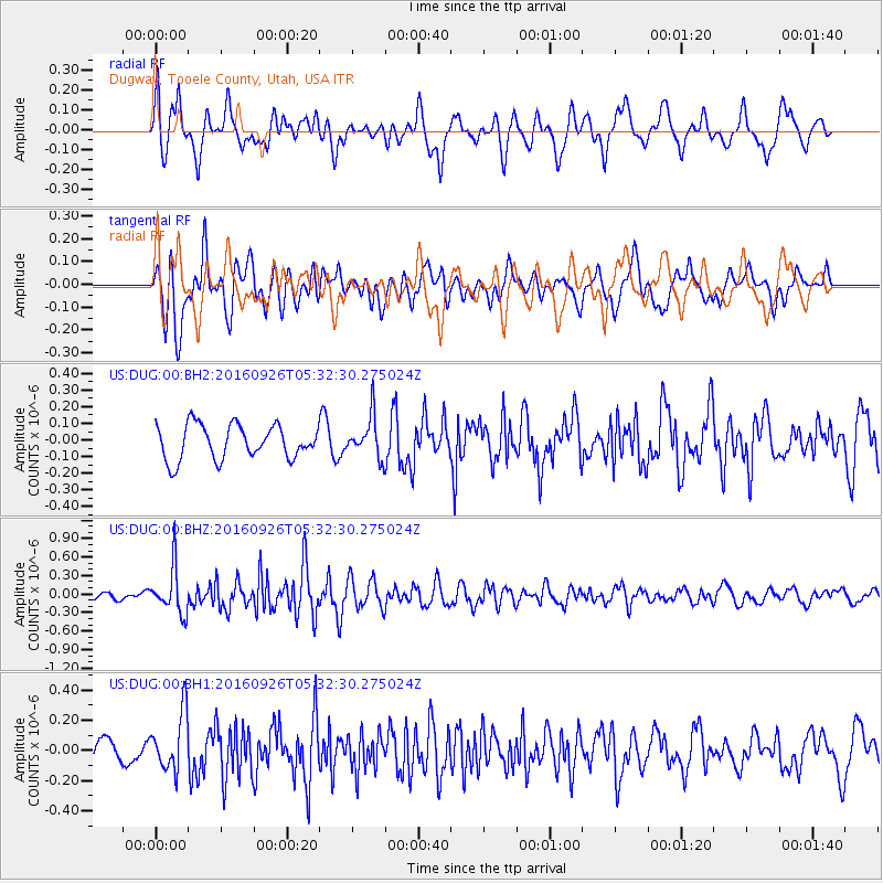
DUG Dugway, Tooele County, Utah, USA - Earthquake Result Viewer
*The percent match for this event was below the threshold and hence no stack was calculated.
| Earthquake location: |
Ryukyu Islands, Japan |
| Earthquake latitude/longitude: |
27.5/128.6 |
| Earthquake time(UTC): |
2016/09/26 (270) 05:19:58 GMT |
| Earthquake Depth: |
40 km |
| Earthquake Magnitude: |
6.0 MB |
| Earthquake Catalog/Contributor: |
NEIC PDE/NEIC ALERT |
|
| Network: |
US United States National Seismic Network |
| Station: |
DUG Dugway, Tooele County, Utah, USA |
| Lat/Lon: |
40.19 N/112.81 W |
| Elevation: |
1477 m |
|
| Distance: |
91.8 deg |
| Az: |
42.274 deg |
| Baz: |
308.714 deg |
| Ray Param: |
$rayparam |
*The percent match for this event was below the threshold and hence was not used in the summary stack. |
|
| Radial Match: |
64.72919 % |
| Radial Bump: |
400 |
| Transverse Match: |
69.302414 % |
| Transverse Bump: |
400 |
| SOD ConfigId: |
1634031 |
| Insert Time: |
2016-10-10 05:23:04.489 +0000 |
| GWidth: |
2.5 |
| Max Bumps: |
400 |
| Tol: |
0.001 |
|
Signal To Noise
| Channel | StoN | STA | LTA |
| US:DUG:00:BHZ:20160926T05:32:30.275024Z | 7.2029185 | 3.70712E-7 | 5.1466916E-8 |
| US:DUG:00:BH1:20160926T05:32:30.275024Z | 2.7880034 | 1.9148837E-7 | 6.868297E-8 |
| US:DUG:00:BH2:20160926T05:32:30.275024Z | 1.2017986 | 1.2231219E-7 | 1.01774276E-7 |
| Arrivals |
| Ps | |
| PpPs | |
| PsPs/PpSs | |


