You are here: Home > Network List > US - United States National Seismic Network Stations List
> Station EGMT Eagleton, Montana, USA > Earthquake Result Viewer
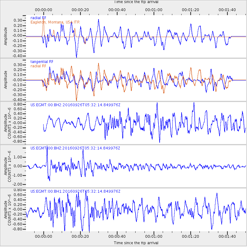
EGMT Eagleton, Montana, USA - Earthquake Result Viewer
*The percent match for this event was below the threshold and hence no stack was calculated.
| Earthquake location: |
Ryukyu Islands, Japan |
| Earthquake latitude/longitude: |
27.5/128.6 |
| Earthquake time(UTC): |
2016/09/26 (270) 05:19:58 GMT |
| Earthquake Depth: |
40 km |
| Earthquake Magnitude: |
6.0 MB |
| Earthquake Catalog/Contributor: |
NEIC PDE/NEIC ALERT |
|
| Network: |
US United States National Seismic Network |
| Station: |
EGMT Eagleton, Montana, USA |
| Lat/Lon: |
48.02 N/109.75 W |
| Elevation: |
1055 m |
|
| Distance: |
88.5 deg |
| Az: |
34.851 deg |
| Baz: |
310.857 deg |
| Ray Param: |
$rayparam |
*The percent match for this event was below the threshold and hence was not used in the summary stack. |
|
| Radial Match: |
74.16431 % |
| Radial Bump: |
400 |
| Transverse Match: |
67.87725 % |
| Transverse Bump: |
400 |
| SOD ConfigId: |
1634031 |
| Insert Time: |
2016-10-10 05:23:07.866 +0000 |
| GWidth: |
2.5 |
| Max Bumps: |
400 |
| Tol: |
0.001 |
|
Signal To Noise
| Channel | StoN | STA | LTA |
| US:EGMT:00:BHZ:20160926T05:32:14.849976Z | 9.730114 | 8.272334E-7 | 8.5017845E-8 |
| US:EGMT:00:BH1:20160926T05:32:14.849976Z | 1.4120471 | 2.5055675E-7 | 1.7744219E-7 |
| US:EGMT:00:BH2:20160926T05:32:14.849976Z | 1.3910505 | 2.4502356E-7 | 1.7614282E-7 |
| Arrivals |
| Ps | |
| PpPs | |
| PsPs/PpSs | |


