You are here: Home > Network List > US - United States National Seismic Network Stations List
> Station HAWA Hanford, Washington, USA > Earthquake Result Viewer
HAWA Hanford, Washington, USA - Earthquake Result Viewer
*The percent match for this event was below the threshold and hence no stack was calculated.
| Earthquake location: |
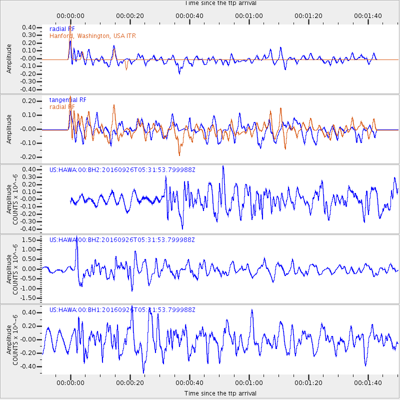
Ryukyu Islands, Japan |
| Earthquake latitude/longitude: |
27.5/128.6 |
| Earthquake time(UTC): |
2016/09/26 (270) 05:19:58 GMT |
| Earthquake Depth: |
40 km |
| Earthquake Magnitude: |
6.0 MB |
| Earthquake Catalog/Contributor: |
NEIC PDE/NEIC ALERT |
|
| Network: |
US United States National Seismic Network |
| Station: |
HAWA Hanford, Washington, USA |
| Lat/Lon: |
46.39 N/119.53 W |
| Elevation: |
364 m |
|
| Distance: |
84.2 deg |
| Az: |
40.204 deg |
| Baz: |
304.04 deg |
| Ray Param: |
$rayparam |
*The percent match for this event was below the threshold and hence was not used in the summary stack. |
|
| Radial Match: |
61.268227 % |
| Radial Bump: |
400 |
| Transverse Match: |
53.510956 % |
| Transverse Bump: |
400 |
| SOD ConfigId: |
1634031 |
| Insert Time: |
2016-10-10 05:23:12.205 +0000 |
| GWidth: |
2.5 |
| Max Bumps: |
400 |
| Tol: |
0.001 |
|
Signal To Noise
| Channel | StoN | STA | LTA |
| US:HAWA:00:BHZ:20160926T05:31:53.799988Z | 4.7608376 | 6.194452E-7 | 1.3011264E-7 |
| US:HAWA:00:BH1:20160926T05:31:53.799988Z | 1.5918564 | 1.690406E-7 | 1.0619087E-7 |
| US:HAWA:00:BH2:20160926T05:31:53.799988Z | 1.963157 | 1.2426719E-7 | 6.3299666E-8 |
| Arrivals |
| Ps | |
| PpPs | |
| PsPs/PpSs | |


