You are here: Home > Network List > TA - USArray Transportable Network (new EarthScope stations) Stations List
> Station Z27A Tatum, NM, USA > Earthquake Result Viewer
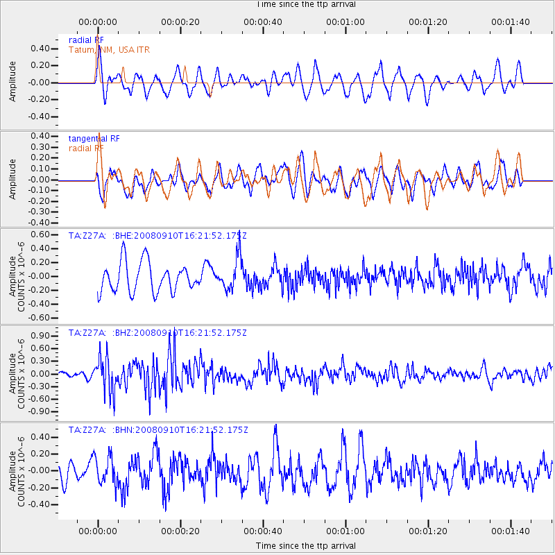
Z27A Tatum, NM, USA - Earthquake Result Viewer
*The percent match for this event was below the threshold and hence no stack was calculated.
| Earthquake location: |
Northern Chile |
| Earthquake latitude/longitude: |
-20.3/-69.2 |
| Earthquake time(UTC): |
2008/09/10 (254) 16:12:04 GMT |
| Earthquake Depth: |
38 km |
| Earthquake Magnitude: |
5.6 MB, 5.3 MS |
| Earthquake Catalog/Contributor: |
WHDF/NEIC |
|
| Network: |
TA USArray Transportable Network (new EarthScope stations) |
| Station: |
Z27A Tatum, NM, USA |
| Lat/Lon: |
33.31 N/103.21 W |
| Elevation: |
1197 m |
|
| Distance: |
62.4 deg |
| Az: |
328.107 deg |
| Baz: |
143.673 deg |
| Ray Param: |
$rayparam |
*The percent match for this event was below the threshold and hence was not used in the summary stack. |
|
| Radial Match: |
55.600292 % |
| Radial Bump: |
400 |
| Transverse Match: |
52.430573 % |
| Transverse Bump: |
400 |
| SOD ConfigId: |
2560 |
| Insert Time: |
2010-03-06 20:48:19.682 +0000 |
| GWidth: |
2.5 |
| Max Bumps: |
400 |
| Tol: |
0.001 |
|
Signal To Noise
| Channel | StoN | STA | LTA |
| TA:Z27A: :BHZ:20080910T16:21:52.175Z | 4.240123 | 4.0733872E-7 | 9.6067666E-8 |
| TA:Z27A: :BHN:20080910T16:21:52.175Z | 1.0160403 | 1.6063218E-7 | 1.5809627E-7 |
| TA:Z27A: :BHE:20080910T16:21:52.175Z | 1.1273336 | 2.360345E-7 | 2.0937412E-7 |
| Arrivals |
| Ps | |
| PpPs | |
| PsPs/PpSs | |


