You are here: Home > Network List > TA - USArray Transportable Network (new EarthScope stations) Stations List
> Station Z27A Tatum, NM, USA > Earthquake Result Viewer
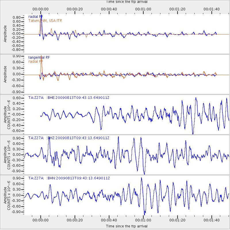
Z27A Tatum, NM, USA - Earthquake Result Viewer
*The percent match for this event was below the threshold and hence no stack was calculated.
| Earthquake location: |
Off Coast Of Costa Rica |
| Earthquake latitude/longitude: |
7.9/-85.6 |
| Earthquake time(UTC): |
2009/08/13 (225) 09:37:35 GMT |
| Earthquake Depth: |
10 km |
| Earthquake Magnitude: |
5.8 MW, 5.3 MB |
| Earthquake Catalog/Contributor: |
WHDF/NEIC |
|
| Network: |
TA USArray Transportable Network (new EarthScope stations) |
| Station: |
Z27A Tatum, NM, USA |
| Lat/Lon: |
33.31 N/103.21 W |
| Elevation: |
1197 m |
|
| Distance: |
30.0 deg |
| Az: |
329.642 deg |
| Baz: |
143.284 deg |
| Ray Param: |
$rayparam |
*The percent match for this event was below the threshold and hence was not used in the summary stack. |
|
| Radial Match: |
75.80334 % |
| Radial Bump: |
348 |
| Transverse Match: |
48.07979 % |
| Transverse Bump: |
400 |
| SOD ConfigId: |
2622 |
| Insert Time: |
2010-03-06 20:48:28.266 +0000 |
| GWidth: |
2.5 |
| Max Bumps: |
400 |
| Tol: |
0.001 |
|
Signal To Noise
| Channel | StoN | STA | LTA |
| TA:Z27A: :BHZ:20090813T09:43:13.649011Z | 2.3659534 | 3.0781231E-7 | 1.3010074E-7 |
| TA:Z27A: :BHN:20090813T09:43:13.649011Z | 1.328783 | 1.1979472E-7 | 9.015371E-8 |
| TA:Z27A: :BHE:20090813T09:43:13.649011Z | 2.1549342 | 1.7102981E-7 | 7.936661E-8 |
| Arrivals |
| Ps | |
| PpPs | |
| PsPs/PpSs | |


