You are here: Home > Network List > TA - USArray Transportable Network (new EarthScope stations) Stations List
> Station Z27A Tatum, NM, USA > Earthquake Result Viewer
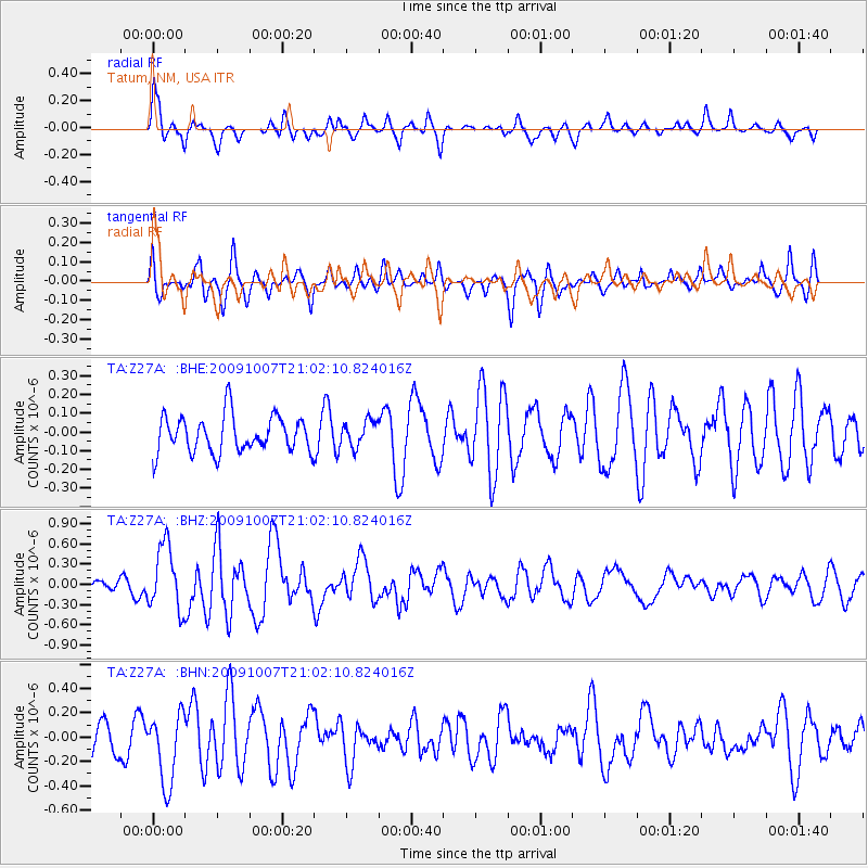
Z27A Tatum, NM, USA - Earthquake Result Viewer
*The percent match for this event was below the threshold and hence no stack was calculated.
| Earthquake location: |
East Of Severnaya Zemlya |
| Earthquake latitude/longitude: |
81.6/119.5 |
| Earthquake time(UTC): |
2009/10/07 (280) 20:52:13 GMT |
| Earthquake Depth: |
8.0 km |
| Earthquake Magnitude: |
5.7 MB, 5.1 MS, 5.8 MW, 5.8 MW |
| Earthquake Catalog/Contributor: |
WHDF/NEIC |
|
| Network: |
TA USArray Transportable Network (new EarthScope stations) |
| Station: |
Z27A Tatum, NM, USA |
| Lat/Lon: |
33.31 N/103.21 W |
| Elevation: |
1197 m |
|
| Distance: |
63.3 deg |
| Az: |
39.527 deg |
| Baz: |
353.562 deg |
| Ray Param: |
$rayparam |
*The percent match for this event was below the threshold and hence was not used in the summary stack. |
|
| Radial Match: |
62.49529 % |
| Radial Bump: |
392 |
| Transverse Match: |
70.786125 % |
| Transverse Bump: |
400 |
| SOD ConfigId: |
2622 |
| Insert Time: |
2010-03-06 20:48:38.608 +0000 |
| GWidth: |
2.5 |
| Max Bumps: |
400 |
| Tol: |
0.001 |
|
Signal To Noise
| Channel | StoN | STA | LTA |
| TA:Z27A: :BHZ:20091007T21:02:10.824016Z | 5.604238 | 4.80293E-7 | 8.570175E-8 |
| TA:Z27A: :BHN:20091007T21:02:10.824016Z | 1.6882088 | 2.8858219E-7 | 1.7093987E-7 |
| TA:Z27A: :BHE:20091007T21:02:10.824016Z | 0.69415396 | 6.7869884E-8 | 9.777353E-8 |
| Arrivals |
| Ps | |
| PpPs | |
| PsPs/PpSs | |


