You are here: Home > Network List > TA - USArray Transportable Network (new EarthScope stations) Stations List
> Station Z27A Tatum, NM, USA > Earthquake Result Viewer
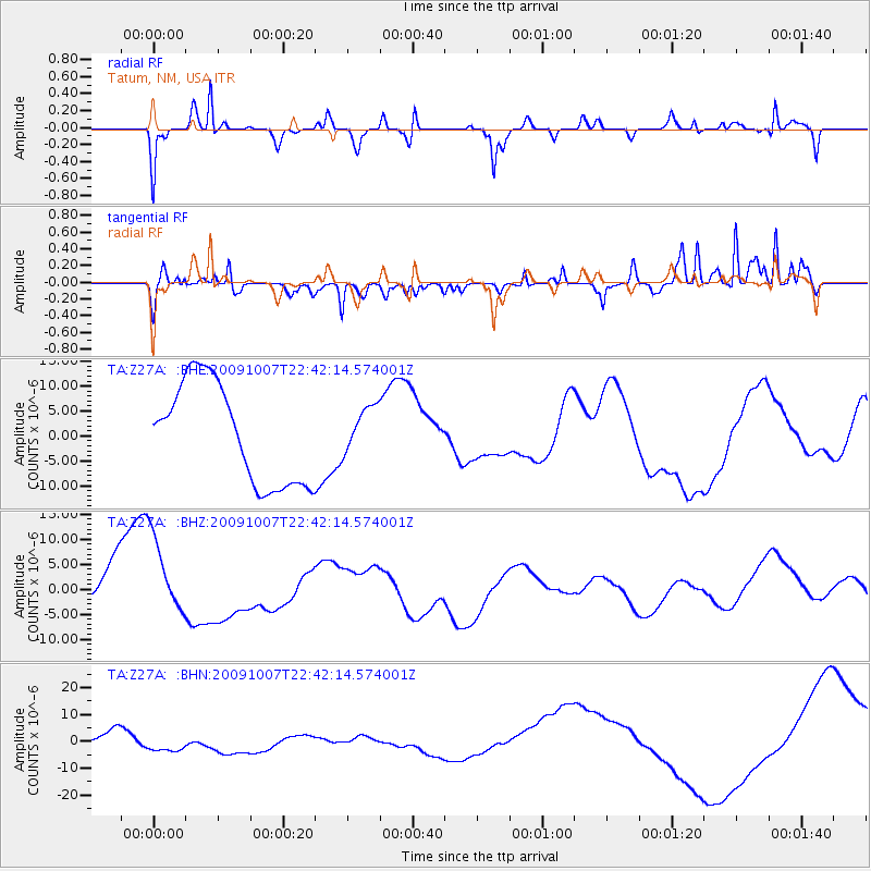
Z27A Tatum, NM, USA - Earthquake Result Viewer
*The percent match for this event was below the threshold and hence no stack was calculated.
| Earthquake location: |
Santa Cruz Islands |
| Earthquake latitude/longitude: |
-11.5/166.0 |
| Earthquake time(UTC): |
2009/10/07 (280) 22:29:18 GMT |
| Earthquake Depth: |
35 km |
| Earthquake Magnitude: |
5.5 MB |
| Earthquake Catalog/Contributor: |
WHDF/NEIC |
|
| Network: |
TA USArray Transportable Network (new EarthScope stations) |
| Station: |
Z27A Tatum, NM, USA |
| Lat/Lon: |
33.31 N/103.21 W |
| Elevation: |
1197 m |
|
| Distance: |
96.8 deg |
| Az: |
57.489 deg |
| Baz: |
260.791 deg |
| Ray Param: |
$rayparam |
*The percent match for this event was below the threshold and hence was not used in the summary stack. |
|
| Radial Match: |
68.80635 % |
| Radial Bump: |
282 |
| Transverse Match: |
56.253532 % |
| Transverse Bump: |
321 |
| SOD ConfigId: |
2622 |
| Insert Time: |
2010-03-06 20:48:39.433 +0000 |
| GWidth: |
2.5 |
| Max Bumps: |
400 |
| Tol: |
0.001 |
|
Signal To Noise
| Channel | StoN | STA | LTA |
| TA:Z27A: :BHZ:20091007T22:42:14.574001Z | 1.9991876 | 9.003945E-6 | 4.5038014E-6 |
| TA:Z27A: :BHN:20091007T22:42:14.574001Z | 1.5308785 | 3.7497402E-6 | 2.449404E-6 |
| TA:Z27A: :BHE:20091007T22:42:14.574001Z | 0.4643485 | 4.673718E-6 | 1.006511E-5 |
| Arrivals |
| Ps | |
| PpPs | |
| PsPs/PpSs | |


