You are here: Home > Network List > UU - University of Utah Regional Network Stations List
> Station KNB Kanab, UT, USA > Earthquake Result Viewer
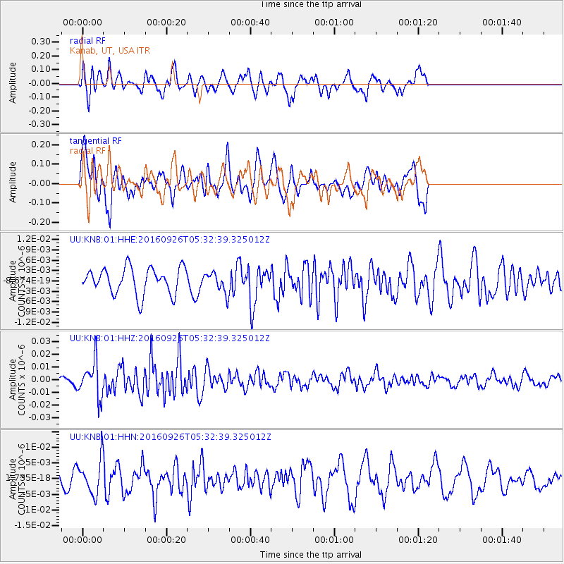
KNB Kanab, UT, USA - Earthquake Result Viewer
*The percent match for this event was below the threshold and hence no stack was calculated.
| Earthquake location: |
Ryukyu Islands, Japan |
| Earthquake latitude/longitude: |
27.5/128.6 |
| Earthquake time(UTC): |
2016/09/26 (270) 05:19:58 GMT |
| Earthquake Depth: |
40 km |
| Earthquake Magnitude: |
6.0 MB |
| Earthquake Catalog/Contributor: |
NEIC PDE/NEIC ALERT |
|
| Network: |
UU University of Utah Regional Network |
| Station: |
KNB Kanab, UT, USA |
| Lat/Lon: |
37.02 N/112.82 W |
| Elevation: |
1715 m |
|
| Distance: |
93.8 deg |
| Az: |
44.759 deg |
| Baz: |
308.589 deg |
| Ray Param: |
$rayparam |
*The percent match for this event was below the threshold and hence was not used in the summary stack. |
|
| Radial Match: |
70.741646 % |
| Radial Bump: |
400 |
| Transverse Match: |
56.83632 % |
| Transverse Bump: |
400 |
| SOD ConfigId: |
1634031 |
| Insert Time: |
2016-10-10 05:23:51.482 +0000 |
| GWidth: |
2.5 |
| Max Bumps: |
400 |
| Tol: |
0.001 |
|
Signal To Noise
| Channel | StoN | STA | LTA |
| UU:KNB:01:HHZ:20160926T05:32:39.325012Z | 5.5283933 | 1.415655E-8 | 2.5606988E-9 |
| UU:KNB:01:HHN:20160926T05:32:39.325012Z | 2.5622864 | 5.580466E-9 | 2.1779243E-9 |
| UU:KNB:01:HHE:20160926T05:32:39.325012Z | 0.77572674 | 2.938128E-9 | 3.7875814E-9 |
| Arrivals |
| Ps | |
| PpPs | |
| PsPs/PpSs | |


