You are here: Home > Network List > TA - USArray Transportable Network (new EarthScope stations) Stations List
> Station Z27A Tatum, NM, USA > Earthquake Result Viewer
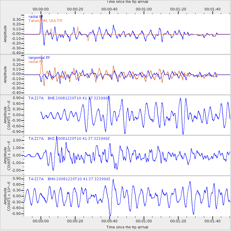
Z27A Tatum, NM, USA - Earthquake Result Viewer
*The percent match for this event was below the threshold and hence no stack was calculated.
| Earthquake location: |
Off East Coast Of Honshu, Japan |
| Earthquake latitude/longitude: |
36.5/142.4 |
| Earthquake time(UTC): |
2008/12/20 (355) 10:29:23 GMT |
| Earthquake Depth: |
19 km |
| Earthquake Magnitude: |
6.0 MB, 6.3 MS, 6.3 MW, 6.3 MW |
| Earthquake Catalog/Contributor: |
WHDF/NEIC |
|
| Network: |
TA USArray Transportable Network (new EarthScope stations) |
| Station: |
Z27A Tatum, NM, USA |
| Lat/Lon: |
33.31 N/103.21 W |
| Elevation: |
1197 m |
|
| Distance: |
87.4 deg |
| Az: |
49.783 deg |
| Baz: |
312.742 deg |
| Ray Param: |
$rayparam |
*The percent match for this event was below the threshold and hence was not used in the summary stack. |
|
| Radial Match: |
67.67014 % |
| Radial Bump: |
359 |
| Transverse Match: |
57.115673 % |
| Transverse Bump: |
328 |
| SOD ConfigId: |
2658 |
| Insert Time: |
2010-03-06 20:49:02.234 +0000 |
| GWidth: |
2.5 |
| Max Bumps: |
400 |
| Tol: |
0.001 |
|
Signal To Noise
| Channel | StoN | STA | LTA |
| TA:Z27A: :BHZ:20081220T10:41:37.323999Z | 7.4539647 | 5.889661E-7 | 7.90138E-8 |
| TA:Z27A: :BHN:20081220T10:41:37.323999Z | 0.85976523 | 1.7782425E-7 | 2.0682884E-7 |
| TA:Z27A: :BHE:20081220T10:41:37.323999Z | 1.8548645 | 3.3803386E-7 | 1.8224182E-7 |
| Arrivals |
| Ps | |
| PpPs | |
| PsPs/PpSs | |


