You are here: Home > Network List > TA - USArray Transportable Network (new EarthScope stations) Stations List
> Station Z27A Tatum, NM, USA > Earthquake Result Viewer
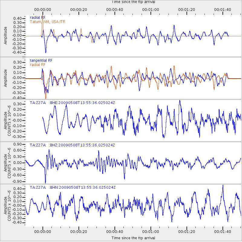
Z27A Tatum, NM, USA - Earthquake Result Viewer
*The percent match for this event was below the threshold and hence no stack was calculated.
| Earthquake location: |
Mendoza Province, Argentina |
| Earthquake latitude/longitude: |
-32.1/-69.7 |
| Earthquake time(UTC): |
2009/05/08 (128) 13:44:53 GMT |
| Earthquake Depth: |
112 km |
| Earthquake Magnitude: |
5.6 MB, 5.4 MW |
| Earthquake Catalog/Contributor: |
WHDF/NEIC |
|
| Network: |
TA USArray Transportable Network (new EarthScope stations) |
| Station: |
Z27A Tatum, NM, USA |
| Lat/Lon: |
33.31 N/103.21 W |
| Elevation: |
1197 m |
|
| Distance: |
72.3 deg |
| Az: |
330.95 deg |
| Baz: |
150.502 deg |
| Ray Param: |
$rayparam |
*The percent match for this event was below the threshold and hence was not used in the summary stack. |
|
| Radial Match: |
61.77002 % |
| Radial Bump: |
400 |
| Transverse Match: |
69.60568 % |
| Transverse Bump: |
400 |
| SOD ConfigId: |
2658 |
| Insert Time: |
2010-03-06 20:49:19.506 +0000 |
| GWidth: |
2.5 |
| Max Bumps: |
400 |
| Tol: |
0.001 |
|
Signal To Noise
| Channel | StoN | STA | LTA |
| TA:Z27A: :BHZ:20090508T13:55:36.025024Z | 3.3703766 | 3.680618E-7 | 1.0920495E-7 |
| TA:Z27A: :BHN:20090508T13:55:36.025024Z | 1.2091694 | 1.1228684E-7 | 9.2862784E-8 |
| TA:Z27A: :BHE:20090508T13:55:36.025024Z | 0.5291622 | 7.058648E-8 | 1.3339289E-7 |
| Arrivals |
| Ps | |
| PpPs | |
| PsPs/PpSs | |


