Y27A Causey, NM, USA - Earthquake Result Viewer
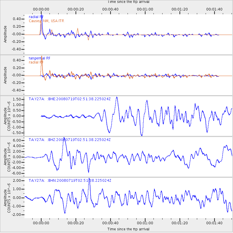
Earthquake location: Off East Coast Of Honshu, Japan
Earthquake latitude/longitude: 37.6/142.2
Earthquake time(UTC): 2008/07/19 (201) 02:39:28 GMT
Earthquake Depth: 22 km
Earthquake Magnitude: 6.2 MB, 7.0 MS, 7.0 MW, 6.9 MW
Earthquake Catalog/Contributor: WHDF/NEIC
Network: TA USArray Transportable Network (new EarthScope stations)
Station: Y27A Causey, NM, USA
Lat/Lon: 33.88 N/103.16 W
Elevation: 1253 m
Distance: 86.5 deg
Az: 49.26 deg
Baz: 313.625 deg
Ray Param: 0.043997828
Estimated Moho Depth: 32.25 km
Estimated Crust Vp/Vs: 1.92
Assumed Crust Vp: 6.129 km/s
Estimated Crust Vs: 3.184 km/s
Estimated Crust Poisson's Ratio: 0.32
Radial Match: 95.63794 %
Radial Bump: 292
Transverse Match: 90.56445 %
Transverse Bump: 400
SOD ConfigId: 2504
Insert Time: 2010-03-06 20:49:35.841 +0000
GWidth: 2.5
Max Bumps: 400
Tol: 0.001

Signal To Noise

ChannelStoNSTALTA
TA:Y27A: :BHZ:20080719T02:51:38.225024Z6.1666547.212422E-71.1695843E-7
TA:Y27A: :BHN:20080719T02:51:38.225024Z1.7028622.211832E-71.2988909E-7
TA:Y27A: :BHE:20080719T02:51:38.225024Z2.72077272.0037906E-77.364785E-8
Arrivals
Ps5.0 SECOND
PpPs15 SECOND
PsPs/PpSs20 SECOND