Y27A Causey, NM, USA - Earthquake Result Viewer
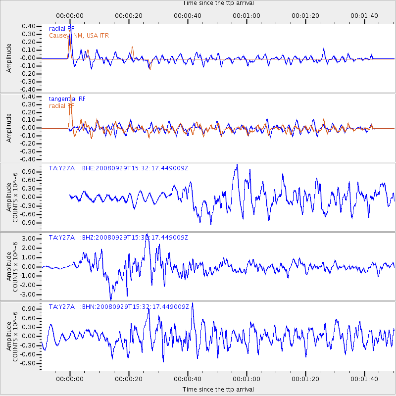
Earthquake location: Kermadec Islands, New Zealand
Earthquake latitude/longitude: -29.8/-177.7
Earthquake time(UTC): 2008/09/29 (273) 15:19:31 GMT
Earthquake Depth: 36 km
Earthquake Magnitude: 6.5 MB, 6.7 MS, 7.0 MW, 7.0 MW
Earthquake Catalog/Contributor: WHDF/NEIC
Network: TA USArray Transportable Network (new EarthScope stations)
Station: Y27A Causey, NM, USA
Lat/Lon: 33.88 N/103.16 W
Elevation: 1253 m
Distance: 94.6 deg
Az: 53.548 deg
Baz: 237.224 deg
Ray Param: 0.04097681
Estimated Moho Depth: 44.5 km
Estimated Crust Vp/Vs: 1.88
Assumed Crust Vp: 6.129 km/s
Estimated Crust Vs: 3.264 km/s
Estimated Crust Poisson's Ratio: 0.30
Radial Match: 87.6428 %
Radial Bump: 400
Transverse Match: 79.70619 %
Transverse Bump: 400
SOD ConfigId: 2560
Insert Time: 2010-03-06 20:49:58.270 +0000
GWidth: 2.5
Max Bumps: 400
Tol: 0.001

Signal To Noise

ChannelStoNSTALTA
TA:Y27A: :BHZ:20080929T15:32:17.449009Z6.72692785.928196E-78.8126356E-8
TA:Y27A: :BHN:20080929T15:32:17.449009Z0.439470868.796298E-82.0015658E-7
TA:Y27A: :BHE:20080929T15:32:17.449009Z1.10426811.2937979E-71.17163395E-7
Arrivals
Ps6.5 SECOND
PpPs21 SECOND
PsPs/PpSs27 SECOND