Y27A Causey, NM, USA - Earthquake Result Viewer
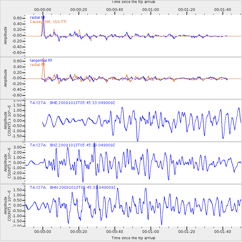
Earthquake location: Fox Islands, Aleutian Islands
Earthquake latitude/longitude: 52.8/-167.0
Earthquake time(UTC): 2009/10/13 (286) 05:37:23 GMT
Earthquake Depth: 24 km
Earthquake Magnitude: 6.0 MB, 6.1 MS, 6.5 MW, 6.5 MW
Earthquake Catalog/Contributor: WHDF/NEIC
Network: TA USArray Transportable Network (new EarthScope stations)
Station: Y27A Causey, NM, USA
Lat/Lon: 33.88 N/103.16 W
Elevation: 1253 m
Distance: 48.4 deg
Az: 86.475 deg
Baz: 313.176 deg
Ray Param: 0.069334015
Estimated Moho Depth: 58.25 km
Estimated Crust Vp/Vs: 1.63
Assumed Crust Vp: 6.129 km/s
Estimated Crust Vs: 3.749 km/s
Estimated Crust Poisson's Ratio: 0.20
Radial Match: 85.431755 %
Radial Bump: 269
Transverse Match: 69.62611 %
Transverse Bump: 371
SOD ConfigId: 2622
Insert Time: 2010-03-06 20:50:16.690 +0000
GWidth: 2.5
Max Bumps: 400
Tol: 0.001

Signal To Noise

ChannelStoNSTALTA
TA:Y27A: :BHZ:20091013T05:45:33.049009Z1.83364095.1357927E-72.8008714E-7
TA:Y27A: :BHN:20091013T05:45:33.049009Z1.04689182.758036E-72.6344995E-7
TA:Y27A: :BHE:20091013T05:45:33.049009Z1.10496473.1142636E-72.818428E-7
Arrivals
Ps6.4 SECOND
PpPs24 SECOND
PsPs/PpSs30 SECOND