Y27A Causey, NM, USA - Earthquake Result Viewer
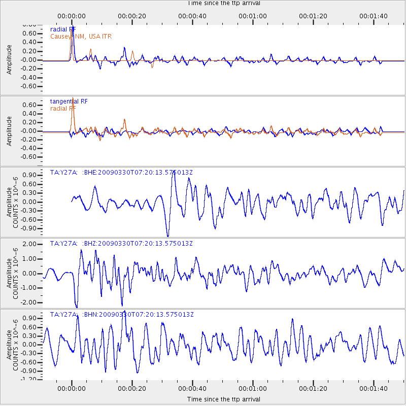
Earthquake location: Kodiak Island Region, Alaska
Earthquake latitude/longitude: 56.5/-152.7
Earthquake time(UTC): 2009/03/30 (089) 07:13:07 GMT
Earthquake Depth: 21 km
Earthquake Magnitude: 5.9 MB, 5.9 MS, 5.9 MW, 5.9 MW
Earthquake Catalog/Contributor: WHDF/NEIC
Network: TA USArray Transportable Network (new EarthScope stations)
Station: Y27A Causey, NM, USA
Lat/Lon: 33.88 N/103.16 W
Elevation: 1253 m
Distance: 40.5 deg
Az: 102.617 deg
Baz: 319.482 deg
Ray Param: 0.07435735
Estimated Moho Depth: 44.25 km
Estimated Crust Vp/Vs: 1.60
Assumed Crust Vp: 6.129 km/s
Estimated Crust Vs: 3.831 km/s
Estimated Crust Poisson's Ratio: 0.18
Radial Match: 87.924576 %
Radial Bump: 309
Transverse Match: 55.825848 %
Transverse Bump: 400
SOD ConfigId: 2658
Insert Time: 2010-03-06 20:50:32.540 +0000
GWidth: 2.5
Max Bumps: 400
Tol: 0.001

Signal To Noise

ChannelStoNSTALTA
TA:Y27A: :BHZ:20090330T07:20:13.575013Z5.8987391.0949294E-61.8562093E-7
TA:Y27A: :BHN:20090330T07:20:13.575013Z1.43418694.2210618E-72.9431743E-7
TA:Y27A: :BHE:20090330T07:20:13.575013Z3.89704376.7412515E-71.7298372E-7
Arrivals
Ps4.6 SECOND
PpPs17 SECOND
PsPs/PpSs22 SECOND