Y27A Causey, NM, USA - Earthquake Result Viewer
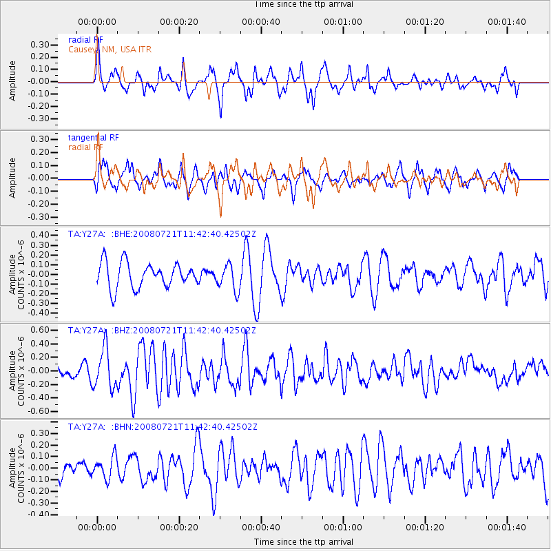
Earthquake location: Off East Coast Of Honshu, Japan
Earthquake latitude/longitude: 37.2/142.1
Earthquake time(UTC): 2008/07/21 (203) 11:30:29 GMT
Earthquake Depth: 22 km
Earthquake Magnitude: 5.7 MB, 5.6 MS, 6.0 MW, 5.9 MW
Earthquake Catalog/Contributor: WHDF/NEIC
Network: TA USArray Transportable Network (new EarthScope stations)
Station: Y27A Causey, NM, USA
Lat/Lon: 33.88 N/103.16 W
Elevation: 1253 m
Distance: 86.8 deg
Az: 49.15 deg
Baz: 313.433 deg
Ray Param: 0.04375095
Estimated Moho Depth: 56.5 km
Estimated Crust Vp/Vs: 2.06
Assumed Crust Vp: 6.129 km/s
Estimated Crust Vs: 2.979 km/s
Estimated Crust Poisson's Ratio: 0.35
Radial Match: 80.72761 %
Radial Bump: 400
Transverse Match: 61.4986 %
Transverse Bump: 400
SOD ConfigId: 2658
Insert Time: 2010-03-06 20:50:36.215 +0000
GWidth: 2.5
Max Bumps: 400
Tol: 0.001

Signal To Noise

ChannelStoNSTALTA
TA:Y27A: :BHZ:20080721T11:42:40.42502Z3.0972373.0045453E-79.700728E-8
TA:Y27A: :BHN:20080721T11:42:40.42502Z1.52390839.666986E-86.3435486E-8
TA:Y27A: :BHE:20080721T11:42:40.42502Z1.06917021.371045E-71.2823449E-7
Arrivals
Ps9.9 SECOND
PpPs28 SECOND
PsPs/PpSs38 SECOND