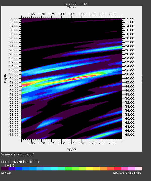
Y27A Causey, NM, USA - Earthquake Result Viewer
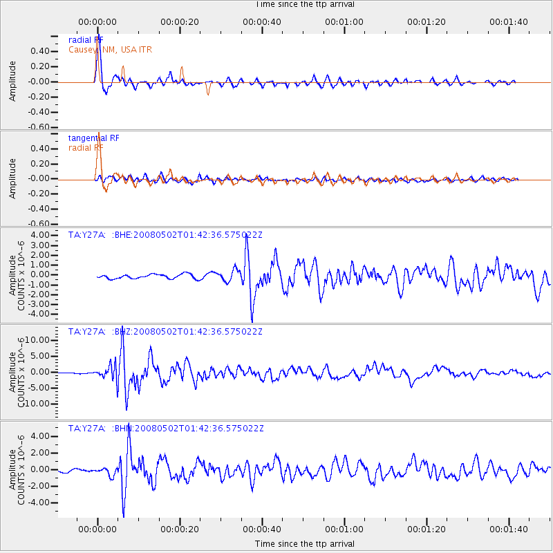
Earthquake location: Andreanof Islands, Aleutian Is.
Earthquake latitude/longitude: 51.9/-177.5
Earthquake time(UTC): 2008/05/02 (123) 01:33:37 GMT
Earthquake Depth: 14 km
Earthquake Magnitude: 6.3 MB, 6.8 MS, 6.6 MW, 6.6 MW
Earthquake Catalog/Contributor: WHDF/NEIC
Network: TA USArray Transportable Network (new EarthScope stations)
Station: Y27A Causey, NM, USA
Lat/Lon: 33.88 N/103.16 W
Elevation: 1253 m
Distance: 54.9 deg
Az: 78.142 deg
Baz: 313.156 deg
Ray Param: 0.06511218
Estimated Moho Depth: 43.75 km
Estimated Crust Vp/Vs: 1.60
Assumed Crust Vp: 6.129 km/s
Estimated Crust Vs: 3.831 km/s
Estimated Crust Poisson's Ratio: 0.18
Radial Match: 96.002884 %
Radial Bump: 362
Transverse Match: 84.551254 %
Transverse Bump: 400
SOD ConfigId: 2504
Insert Time: 2010-03-06 20:50:37.608 +0000
GWidth: 2.5
Max Bumps: 400
Tol: 0.001

Signal To Noise

ChannelStoNSTALTA
TA:Y27A: :BHZ:20080502T01:42:36.575022Z13.7668792.1333046E-61.5495921E-7
TA:Y27A: :BHN:20080502T01:42:36.575022Z2.9416154.8588373E-71.6517583E-7
TA:Y27A: :BHE:20080502T01:42:36.575022Z2.64653335.8353885E-72.2049178E-7
Arrivals
Ps4.5 SECOND
PpPs18 SECOND
PsPs/PpSs22 SECOND