You are here: Home > Network List > TA - USArray Transportable Network (new EarthScope stations) Stations List
> Station Y27A Causey, NM, USA > Earthquake Result Viewer
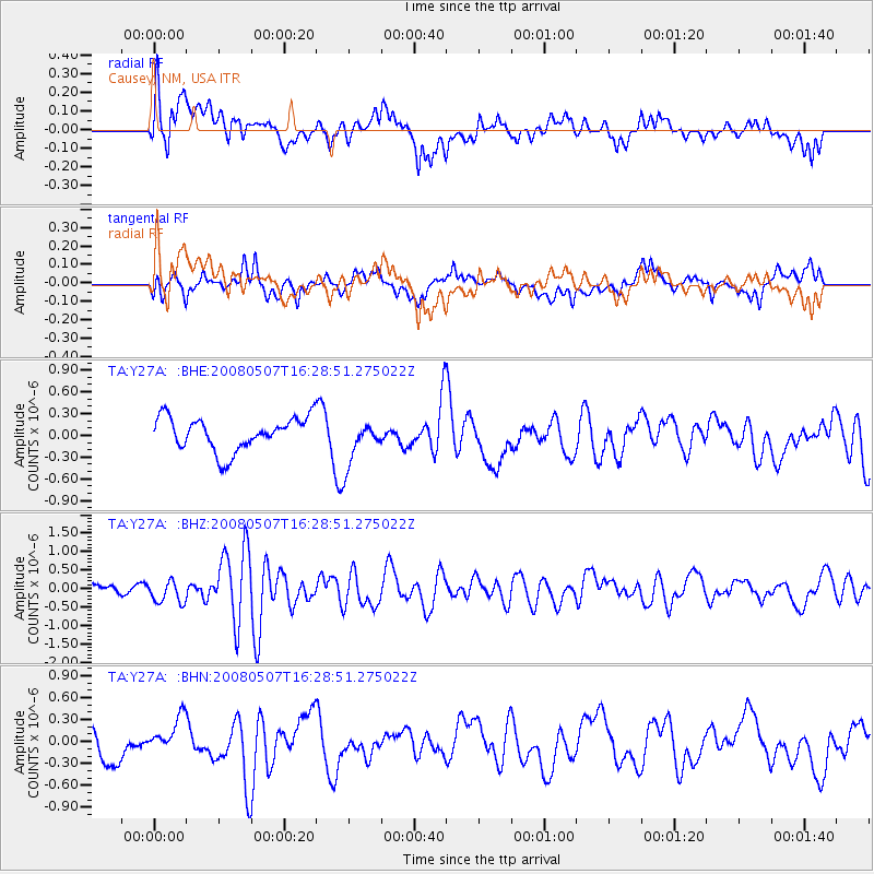
Y27A Causey, NM, USA - Earthquake Result Viewer
*The percent match for this event was below the threshold and hence no stack was calculated.
| Earthquake location: |
Near East Coast Of Honshu, Japan |
| Earthquake latitude/longitude: |
36.2/141.8 |
| Earthquake time(UTC): |
2008/05/07 (128) 16:16:36 GMT |
| Earthquake Depth: |
23 km |
| Earthquake Magnitude: |
5.9 MB, 6.1 MW, 6.0 MW |
| Earthquake Catalog/Contributor: |
WHDF/NEIC |
|
| Network: |
TA USArray Transportable Network (new EarthScope stations) |
| Station: |
Y27A Causey, NM, USA |
| Lat/Lon: |
33.88 N/103.16 W |
| Elevation: |
1253 m |
|
| Distance: |
87.7 deg |
| Az: |
48.945 deg |
| Baz: |
312.812 deg |
| Ray Param: |
$rayparam |
*The percent match for this event was below the threshold and hence was not used in the summary stack. |
|
| Radial Match: |
59.37642 % |
| Radial Bump: |
400 |
| Transverse Match: |
48.08114 % |
| Transverse Bump: |
400 |
| SOD ConfigId: |
2504 |
| Insert Time: |
2010-03-06 20:50:53.805 +0000 |
| GWidth: |
2.5 |
| Max Bumps: |
400 |
| Tol: |
0.001 |
|
Signal To Noise
| Channel | StoN | STA | LTA |
| TA:Y27A: :BHZ:20080507T16:28:51.275022Z | 2.1805003 | 2.977718E-7 | 1.3656123E-7 |
| TA:Y27A: :BHN:20080507T16:28:51.275022Z | 1.1538639 | 2.3797853E-7 | 2.0624489E-7 |
| TA:Y27A: :BHE:20080507T16:28:51.275022Z | 1.372058 | 3.1406597E-7 | 2.2890138E-7 |
| Arrivals |
| Ps | |
| PpPs | |
| PsPs/PpSs | |


