You are here: Home > Network List > TA - USArray Transportable Network (new EarthScope stations) Stations List
> Station G16K Koyuk River, AK, USA > Earthquake Result Viewer
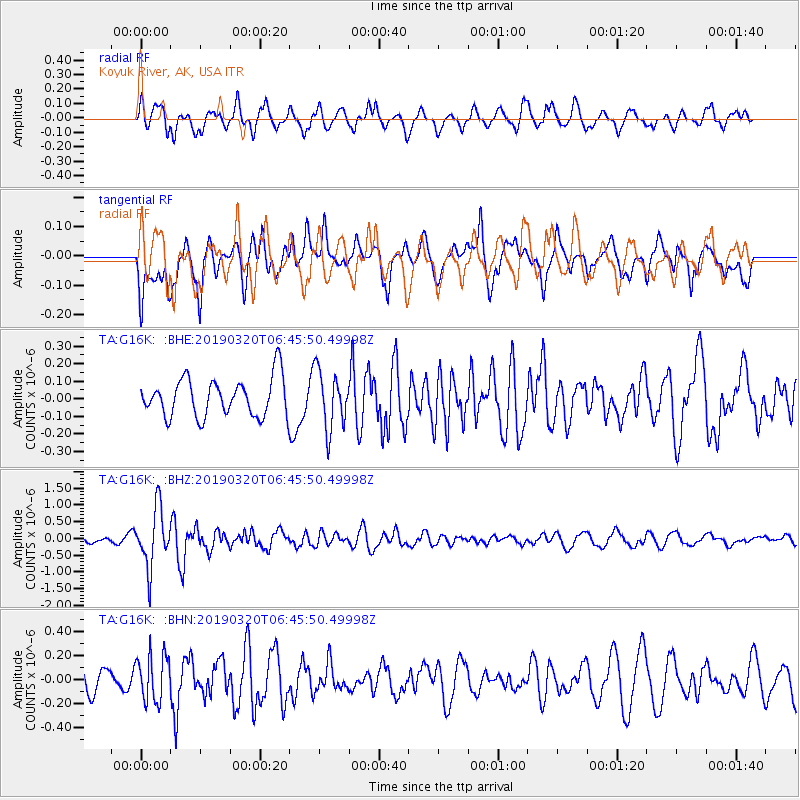
G16K Koyuk River, AK, USA - Earthquake Result Viewer
*The percent match for this event was below the threshold and hence no stack was calculated.
| Earthquake location: |
Turkey |
| Earthquake latitude/longitude: |
37.4/29.6 |
| Earthquake time(UTC): |
2019/03/20 (079) 06:34:28 GMT |
| Earthquake Depth: |
10 km |
| Earthquake Magnitude: |
5.7 Mww |
| Earthquake Catalog/Contributor: |
NEIC PDE/us |
|
| Network: |
TA USArray Transportable Network (new EarthScope stations) |
| Station: |
G16K Koyuk River, AK, USA |
| Lat/Lon: |
65.39 N/162.35 W |
| Elevation: |
169 m |
|
| Distance: |
77.1 deg |
| Az: |
5.09 deg |
| Baz: |
350.29 deg |
| Ray Param: |
$rayparam |
*The percent match for this event was below the threshold and hence was not used in the summary stack. |
|
| Radial Match: |
70.23839 % |
| Radial Bump: |
400 |
| Transverse Match: |
69.57196 % |
| Transverse Bump: |
400 |
| SOD ConfigId: |
13570011 |
| Insert Time: |
2019-05-02 18:33:01.130 +0000 |
| GWidth: |
2.5 |
| Max Bumps: |
400 |
| Tol: |
0.001 |
|
Signal To Noise
| Channel | StoN | STA | LTA |
| TA:G16K: :BHZ:20190320T06:45:50.49998Z | 7.3514357 | 8.6608736E-7 | 1.17812E-7 |
| TA:G16K: :BHN:20190320T06:45:50.49998Z | 2.0472317 | 1.9754995E-7 | 9.649614E-8 |
| TA:G16K: :BHE:20190320T06:45:50.49998Z | 1.5087031 | 1.6372113E-7 | 1.0851779E-7 |
| Arrivals |
| Ps | |
| PpPs | |
| PsPs/PpSs | |


