You are here: Home > Network List > TA - USArray Transportable Network (new EarthScope stations) Stations List
> Station Y27A Causey, NM, USA > Earthquake Result Viewer
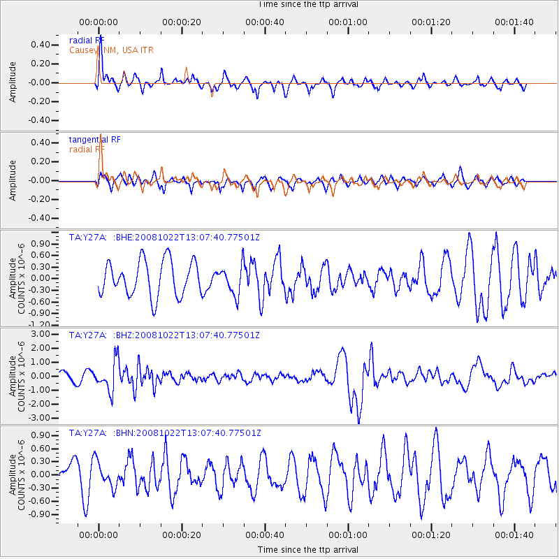
Y27A Causey, NM, USA - Earthquake Result Viewer
*The percent match for this event was below the threshold and hence no stack was calculated.
| Earthquake location: |
Tonga Islands |
| Earthquake latitude/longitude: |
-18.4/-175.4 |
| Earthquake time(UTC): |
2008/10/22 (296) 12:55:57 GMT |
| Earthquake Depth: |
233 km |
| Earthquake Magnitude: |
5.9 MB, 6.4 MW, 6.3 MW |
| Earthquake Catalog/Contributor: |
WHDF/NEIC |
|
| Network: |
TA USArray Transportable Network (new EarthScope stations) |
| Station: |
Y27A Causey, NM, USA |
| Lat/Lon: |
33.88 N/103.16 W |
| Elevation: |
1253 m |
|
| Distance: |
86.1 deg |
| Az: |
52.544 deg |
| Baz: |
244.955 deg |
| Ray Param: |
$rayparam |
*The percent match for this event was below the threshold and hence was not used in the summary stack. |
|
| Radial Match: |
61.936043 % |
| Radial Bump: |
361 |
| Transverse Match: |
43.204308 % |
| Transverse Bump: |
326 |
| SOD ConfigId: |
2560 |
| Insert Time: |
2010-03-06 20:51:25.401 +0000 |
| GWidth: |
2.5 |
| Max Bumps: |
400 |
| Tol: |
0.001 |
|
Signal To Noise
| Channel | StoN | STA | LTA |
| TA:Y27A: :BHZ:20081022T13:07:40.77501Z | 2.4357662 | 1.1174106E-6 | 4.5875117E-7 |
| TA:Y27A: :BHN:20081022T13:07:40.77501Z | 0.5396016 | 2.7860887E-7 | 5.1632327E-7 |
| TA:Y27A: :BHE:20081022T13:07:40.77501Z | 0.868675 | 3.9054441E-7 | 4.4958634E-7 |
| Arrivals |
| Ps | |
| PpPs | |
| PsPs/PpSs | |


