You are here: Home > Network List > TA - USArray Transportable Network (new EarthScope stations) Stations List
> Station Y27A Causey, NM, USA > Earthquake Result Viewer
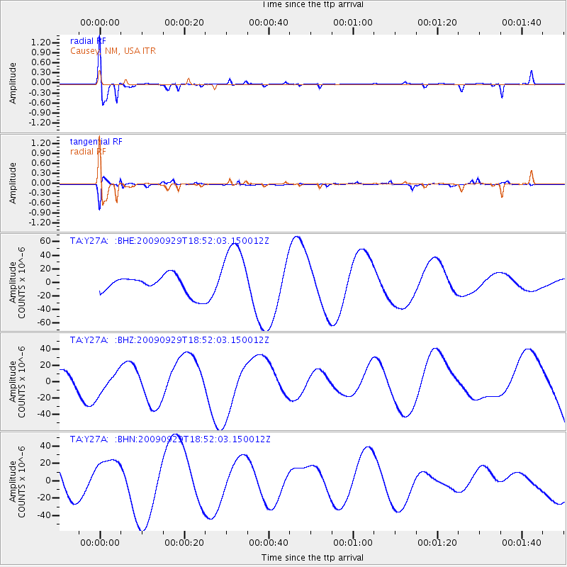
Y27A Causey, NM, USA - Earthquake Result Viewer
*The percent match for this event was below the threshold and hence no stack was calculated.
| Earthquake location: |
Tonga Islands |
| Earthquake latitude/longitude: |
-15.4/-173.2 |
| Earthquake time(UTC): |
2009/09/29 (272) 18:40:09 GMT |
| Earthquake Depth: |
2.3 km |
| Earthquake Magnitude: |
5.5 MB |
| Earthquake Catalog/Contributor: |
WHDF/NEIC |
|
| Network: |
TA USArray Transportable Network (new EarthScope stations) |
| Station: |
Y27A Causey, NM, USA |
| Lat/Lon: |
33.88 N/103.16 W |
| Elevation: |
1253 m |
|
| Distance: |
82.7 deg |
| Az: |
52.048 deg |
| Baz: |
246.128 deg |
| Ray Param: |
$rayparam |
*The percent match for this event was below the threshold and hence was not used in the summary stack. |
|
| Radial Match: |
65.854164 % |
| Radial Bump: |
322 |
| Transverse Match: |
69.87897 % |
| Transverse Bump: |
394 |
| SOD ConfigId: |
2622 |
| Insert Time: |
2010-03-06 20:51:41.594 +0000 |
| GWidth: |
2.5 |
| Max Bumps: |
400 |
| Tol: |
0.001 |
|
Signal To Noise
| Channel | StoN | STA | LTA |
| TA:Y27A: :BHZ:20090929T18:52:03.150012Z | 0.64331484 | 1.2511377E-5 | 1.9448295E-5 |
| TA:Y27A: :BHN:20090929T18:52:03.150012Z | 1.3855069 | 2.2956416E-5 | 1.6568965E-5 |
| TA:Y27A: :BHE:20090929T18:52:03.150012Z | 3.4795742 | 4.738739E-5 | 1.3618733E-5 |
| Arrivals |
| Ps | |
| PpPs | |
| PsPs/PpSs | |


