You are here: Home > Network List > TA - USArray Transportable Network (new EarthScope stations) Stations List
> Station Y27A Causey, NM, USA > Earthquake Result Viewer
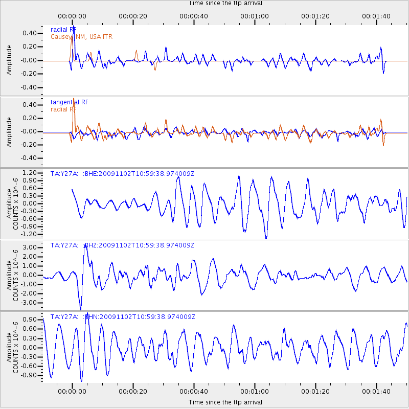
Y27A Causey, NM, USA - Earthquake Result Viewer
*The percent match for this event was below the threshold and hence no stack was calculated.
| Earthquake location: |
South Of Tonga Islands |
| Earthquake latitude/longitude: |
-24.1/-175.2 |
| Earthquake time(UTC): |
2009/11/02 (306) 10:47:13 GMT |
| Earthquake Depth: |
9.0 km |
| Earthquake Magnitude: |
6.1 MB, 6.1 MS, 6.2 MW, 6.1 MW |
| Earthquake Catalog/Contributor: |
WHDF/NEIC |
|
| Network: |
TA USArray Transportable Network (new EarthScope stations) |
| Station: |
Y27A Causey, NM, USA |
| Lat/Lon: |
33.88 N/103.16 W |
| Elevation: |
1253 m |
|
| Distance: |
89.5 deg |
| Az: |
52.303 deg |
| Baz: |
240.351 deg |
| Ray Param: |
$rayparam |
*The percent match for this event was below the threshold and hence was not used in the summary stack. |
|
| Radial Match: |
67.2339 % |
| Radial Bump: |
400 |
| Transverse Match: |
45.563984 % |
| Transverse Bump: |
378 |
| SOD ConfigId: |
2622 |
| Insert Time: |
2010-03-06 20:51:48.893 +0000 |
| GWidth: |
2.5 |
| Max Bumps: |
400 |
| Tol: |
0.001 |
|
Signal To Noise
| Channel | StoN | STA | LTA |
| TA:Y27A: :BHZ:20091102T10:59:38.974009Z | 10.182971 | 1.9372208E-6 | 1.9024121E-7 |
| TA:Y27A: :BHN:20091102T10:59:38.974009Z | 1.1481729 | 6.15483E-7 | 5.360543E-7 |
| TA:Y27A: :BHE:20091102T10:59:38.974009Z | 2.5738544 | 4.798888E-7 | 1.8644754E-7 |
| Arrivals |
| Ps | |
| PpPs | |
| PsPs/PpSs | |


