You are here: Home > Network List > TA - USArray Transportable Network (new EarthScope stations) Stations List
> Station Y27A Causey, NM, USA > Earthquake Result Viewer
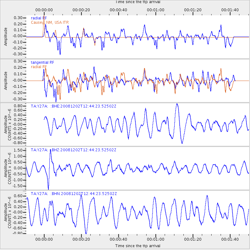
Y27A Causey, NM, USA - Earthquake Result Viewer
*The percent match for this event was below the threshold and hence no stack was calculated.
| Earthquake location: |
Mariana Islands |
| Earthquake latitude/longitude: |
19.1/145.8 |
| Earthquake time(UTC): |
2008/12/02 (337) 12:31:43 GMT |
| Earthquake Depth: |
137 km |
| Earthquake Magnitude: |
5.9 MB, 5.9 MW, 5.9 MW |
| Earthquake Catalog/Contributor: |
WHDF/NEIC |
|
| Network: |
TA USArray Transportable Network (new EarthScope stations) |
| Station: |
Y27A Causey, NM, USA |
| Lat/Lon: |
33.88 N/103.16 W |
| Elevation: |
1253 m |
|
| Distance: |
95.9 deg |
| Az: |
51.288 deg |
| Baz: |
297.51 deg |
| Ray Param: |
$rayparam |
*The percent match for this event was below the threshold and hence was not used in the summary stack. |
|
| Radial Match: |
56.656857 % |
| Radial Bump: |
400 |
| Transverse Match: |
59.341988 % |
| Transverse Bump: |
400 |
| SOD ConfigId: |
2658 |
| Insert Time: |
2010-03-06 20:51:55.541 +0000 |
| GWidth: |
2.5 |
| Max Bumps: |
400 |
| Tol: |
0.001 |
|
Signal To Noise
| Channel | StoN | STA | LTA |
| TA:Y27A: :BHZ:20081202T12:44:23.52502Z | 2.986953 | 8.3182846E-7 | 2.7848728E-7 |
| TA:Y27A: :BHN:20081202T12:44:23.52502Z | 0.76075655 | 2.780995E-7 | 3.655565E-7 |
| TA:Y27A: :BHE:20081202T12:44:23.52502Z | 0.8558351 | 2.046186E-7 | 2.390865E-7 |
| Arrivals |
| Ps | |
| PpPs | |
| PsPs/PpSs | |


