You are here: Home > Network List > TA - USArray Transportable Network (new EarthScope stations) Stations List
> Station Y27A Causey, NM, USA > Earthquake Result Viewer
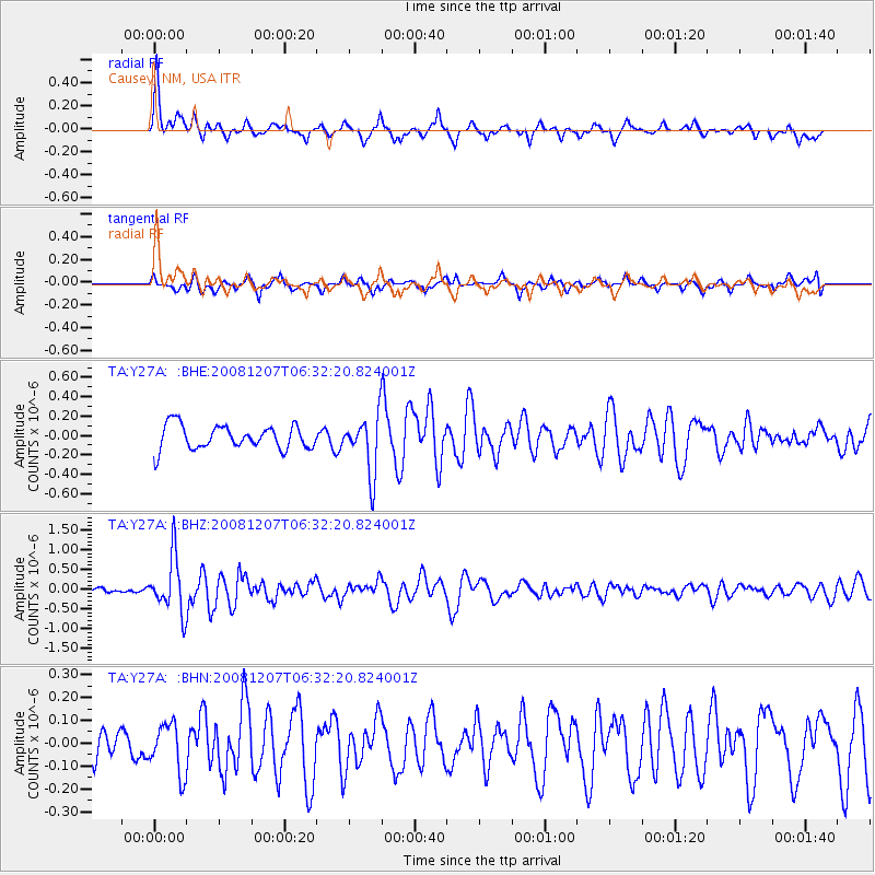
Y27A Causey, NM, USA - Earthquake Result Viewer
*The percent match for this event was below the threshold and hence no stack was calculated.
| Earthquake location: |
Northern Mid-Atlantic Ridge |
| Earthquake latitude/longitude: |
13.4/-44.8 |
| Earthquake time(UTC): |
2008/12/07 (342) 06:23:09 GMT |
| Earthquake Depth: |
10 km |
| Earthquake Magnitude: |
5.6 MB, 5.3 MS, 5.7 MW |
| Earthquake Catalog/Contributor: |
WHDF/NEIC |
|
| Network: |
TA USArray Transportable Network (new EarthScope stations) |
| Station: |
Y27A Causey, NM, USA |
| Lat/Lon: |
33.88 N/103.16 W |
| Elevation: |
1253 m |
|
| Distance: |
56.5 deg |
| Az: |
301.854 deg |
| Baz: |
96.382 deg |
| Ray Param: |
$rayparam |
*The percent match for this event was below the threshold and hence was not used in the summary stack. |
|
| Radial Match: |
72.67122 % |
| Radial Bump: |
387 |
| Transverse Match: |
63.651165 % |
| Transverse Bump: |
400 |
| SOD ConfigId: |
2658 |
| Insert Time: |
2010-03-06 20:51:57.745 +0000 |
| GWidth: |
2.5 |
| Max Bumps: |
400 |
| Tol: |
0.001 |
|
Signal To Noise
| Channel | StoN | STA | LTA |
| TA:Y27A: :BHZ:20081207T06:32:20.824001Z | 8.650588 | 6.9926296E-7 | 8.083415E-8 |
| TA:Y27A: :BHN:20081207T06:32:20.824001Z | 1.3597728 | 1.0745847E-7 | 7.902678E-8 |
| TA:Y27A: :BHE:20081207T06:32:20.824001Z | 2.4328432 | 2.9905553E-7 | 1.2292429E-7 |
| Arrivals |
| Ps | |
| PpPs | |
| PsPs/PpSs | |


