You are here: Home > Network List > TA - USArray Transportable Network (new EarthScope stations) Stations List
> Station Y27A Causey, NM, USA > Earthquake Result Viewer
Y27A Causey, NM, USA - Earthquake Result Viewer
*The percent match for this event was below the threshold and hence no stack was calculated.
| Earthquake location: |
Northern Mid-Atlantic Ridge |
| Earthquake latitude/longitude: |
13.4/-44.8 |
| Earthquake time(UTC): |
2008/12/08 (343) 01:51:01 GMT |
| Earthquake Depth: |
10 km |
| Earthquake Magnitude: |
5.6 MB, 5.1 MS, 5.5 MW, 5.5 MW |
| Earthquake Catalog/Contributor: |
WHDF/NEIC |
|
| Network: |
TA USArray Transportable Network (new EarthScope stations) |
| Station: |
Y27A Causey, NM, USA |
| Lat/Lon: |
33.88 N/103.16 W |
| Elevation: |
1253 m |
|
| Distance: |
56.5 deg |
| Az: |
301.814 deg |
| Baz: |
96.297 deg |
| Ray Param: |
$rayparam |
*The percent match for this event was below the threshold and hence was not used in the summary stack. |
|
| Radial Match: |
63.98298 % |
| Radial Bump: |
391 |
| Transverse Match: |
52.0094 % |
| Transverse Bump: |
370 |
| SOD ConfigId: |
2658 |
| Insert Time: |
2010-03-06 20:52:00.534 +0000 |
| GWidth: |
2.5 |
| Max Bumps: |
400 |
| Tol: |
0.001 |
|
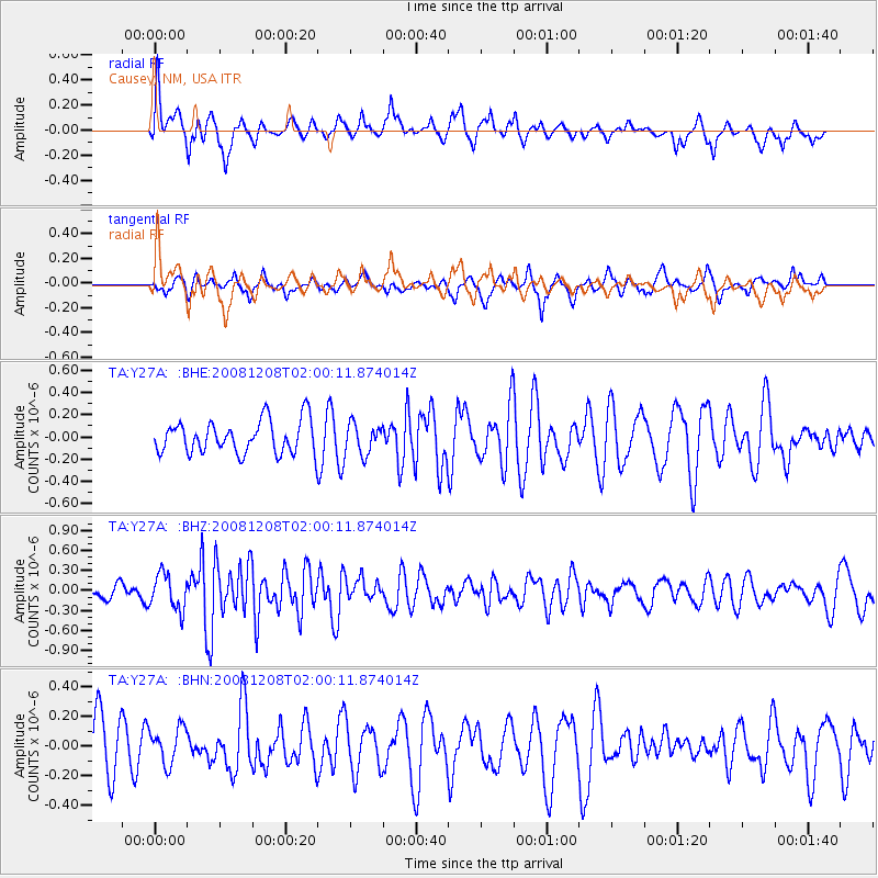
Signal To Noise
| Channel | StoN | STA | LTA |
| TA:Y27A: :BHZ:20081208T02:00:11.874014Z | 2.4443078 | 2.683886E-7 | 1.09801476E-7 |
| TA:Y27A: :BHN:20081208T02:00:11.874014Z | 0.542905 | 1.2073889E-7 | 2.2239416E-7 |
| TA:Y27A: :BHE:20081208T02:00:11.874014Z | 0.9158626 | 1.3508439E-7 | 1.4749416E-7 |
| Arrivals |
| Ps | |
| PpPs | |
| PsPs/PpSs | |


