You are here: Home > Network List > II - Global Seismograph Network (GSN - IRIS/IDA) Stations List
> Station WRAB Tennant Creek, NT, Australia > Earthquake Result Viewer
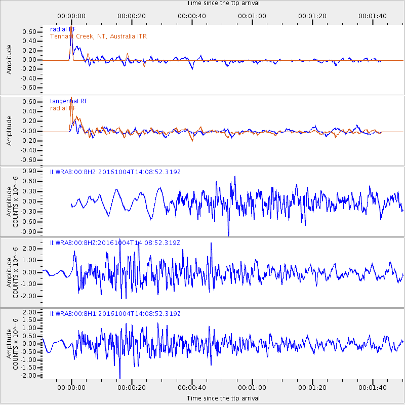
WRAB Tennant Creek, NT, Australia - Earthquake Result Viewer
*The percent match for this event was below the threshold and hence no stack was calculated.
| Earthquake location: |
Bonin Islands, Japan Region |
| Earthquake latitude/longitude: |
27.9/142.0 |
| Earthquake time(UTC): |
2016/10/04 (278) 14:00:46 GMT |
| Earthquake Depth: |
30 km |
| Earthquake Magnitude: |
5.6 MO |
| Earthquake Catalog/Contributor: |
NEIC PDE/NEIC ALERT |
|
| Network: |
II Global Seismograph Network (GSN - IRIS/IDA) |
| Station: |
WRAB Tennant Creek, NT, Australia |
| Lat/Lon: |
19.93 S/134.36 E |
| Elevation: |
366 m |
|
| Distance: |
48.1 deg |
| Az: |
189.62 deg |
| Baz: |
9.046 deg |
| Ray Param: |
$rayparam |
*The percent match for this event was below the threshold and hence was not used in the summary stack. |
|
| Radial Match: |
75.61887 % |
| Radial Bump: |
400 |
| Transverse Match: |
67.78344 % |
| Transverse Bump: |
400 |
| SOD ConfigId: |
1634031 |
| Insert Time: |
2016-10-18 14:05:10.232 +0000 |
| GWidth: |
2.5 |
| Max Bumps: |
400 |
| Tol: |
0.001 |
|
Signal To Noise
| Channel | StoN | STA | LTA |
| II:WRAB:00:BHZ:20161004T14:08:52.319Z | 4.650993 | 8.721256E-7 | 1.8751386E-7 |
| II:WRAB:00:BH1:20161004T14:08:52.319Z | 2.1468494 | 4.3299556E-7 | 2.0168885E-7 |
| II:WRAB:00:BH2:20161004T14:08:52.319Z | 1.3870226 | 2.4437708E-7 | 1.7618824E-7 |
| Arrivals |
| Ps | |
| PpPs | |
| PsPs/PpSs | |


